Coyote Mountain
| Site Name: | Coyote Mountain | 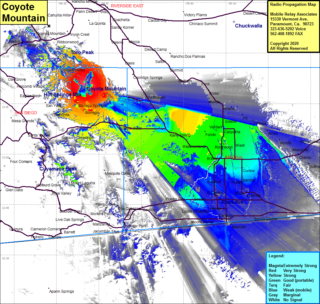 Coyote Mountain Coverage |
| Latitude: | 033 20 36.8N | 33.3435556 |
| Longitude: | 116 19 43.8W | -116.3288333 |
| Feet | Meters | |
| Ground Elevation: | 3190 | 972.3 |
| HAAT: | 1416.2 | 431.67 |
| City: | Borrego Springs | |
| County: | San Diego | |
| State: | California |
This is not an MRA Owned Site. For space rental contact the site owner.
Do you own or manage this site? Click Here
Would you like to add a site to the Google Earth Map?? Click Here
Site Coverage: Coverage of northeastern San Diego County and Imperial County including Borrego, Borrego Springs, Gyucca Valley, Ocotillo Wells, Karie Spring, Westmorland, Rockwood, Wiest, Calipatria, Verdant, Fondo, Estellle, Niland, Munde, Wister, Frink, Iris, Tortuga, Amos, Acolita, Mesquite, Glamis, Ruthven, Curlew, Sandia, Fuller, Roco, El Centro, Imperial, Heber, Calexico, Bonds Corner, Mount Signal, Truckhaven
Amateur (ham) frequencies: