Crestline Peak
| Site Name: | Crestline Peak | 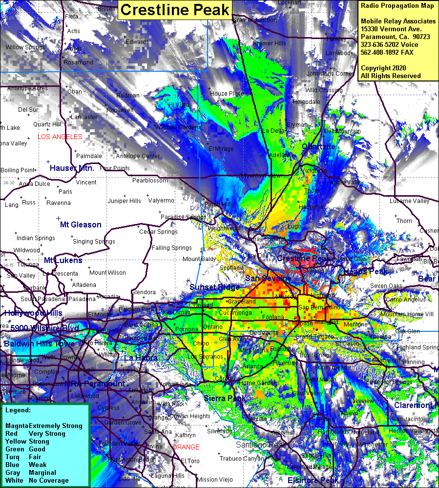 Crestline Peak Coverage |
| Latitude: | 034 13 58.3N | 34.2328611 |
| Longitude: | 117 16 40.8W | -117.2780000 |
| Feet | Meters | |
| Ground Elevation: | 5436.4 | 1657.0 |
| HAAT: | 2113.1 | 644.1 |
| City: | Crestline | |
| County: | San Bernardino | |
| State: | California |
This is not an MRA Owned Site. For space rental contact the site owner.
Do you own or manage this site? Click Here
Would you like to add a site to the Google Earth Map?? Click Here
Site Coverage: Coverage of the Crestline area, Inland Empire from Kellogg Hill to Beaumont and from the Jct of I15 & I215 to Murietta, San Bernardino, High Desert, Lugo, Hesperia, Thom, Victorville, Oro Grande, Adelanto, Mountain View, Frost, Apple Valley, Helendale, Twin Peaks, Arrowhead Highlands, Skyland, Cedarpines Park, Rimforest
Amateur (ham) frequencies: