Cummings Mtn
| Site Name: | Cummings Mtn | 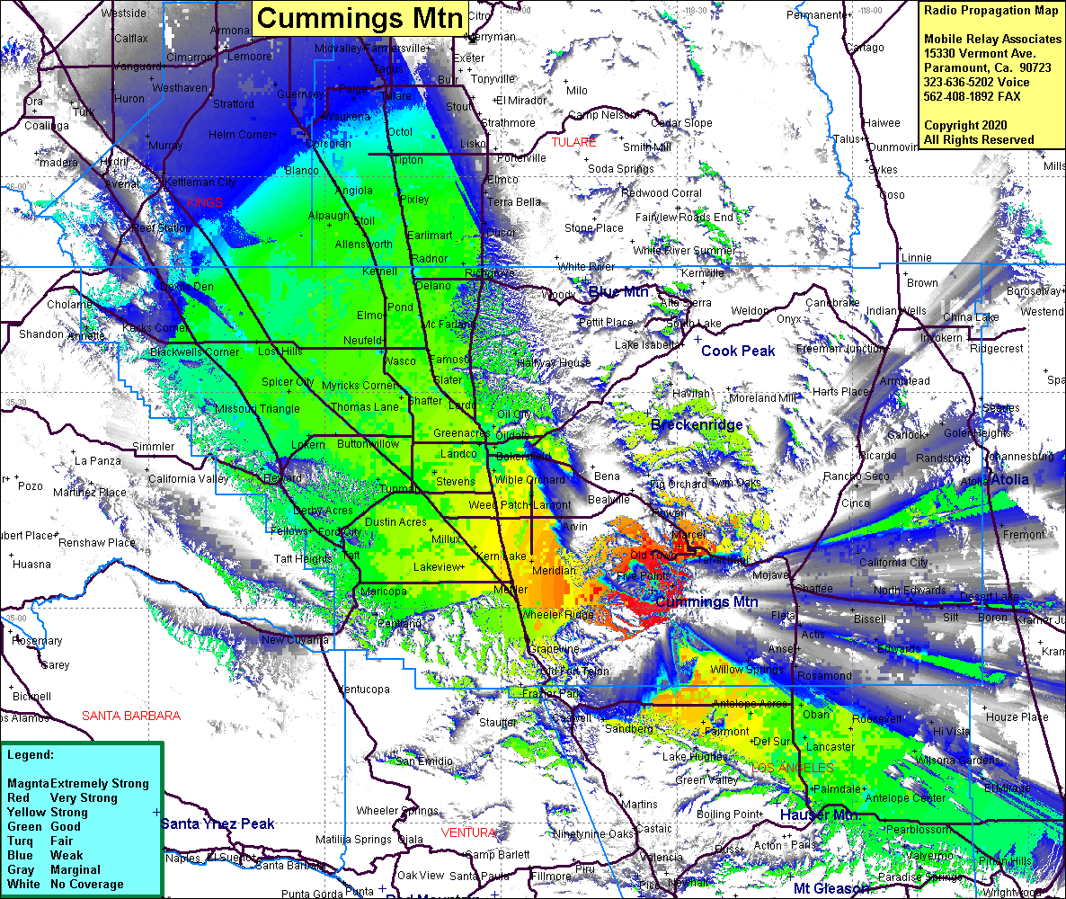 Cummings Mtn Coverage |
| Latitude: | 035 02 29.3N | 35.0414722 |
| Longitude: | 118 34 12.7W | -118.5701944 |
| Feet | Meters | |
| Ground Elevation: | 7756.9 | 2364.3 |
| HAAT: | 3305.0 | 1007.4 |
| City: | Tehachapi | |
| County: | Kern | |
| State: | California |
This is not an MRA Owned Site. For space rental contact the site owner.
Do you own or manage this site? Click Here
Would you like to add a site to the Google Earth Map?? Click Here
Site Coverage: Coverage of the San Joaquin Valley from Grapevine to south of Frenso, Sanberg, Fairmont, Antelope Acres, Lancaster, Palmdale, Pearblossom, Wilsona Gardens, Roosevelt, Oban, Five Points, Old Town, Tehachapi, Cable, Summit, Manolith, Willow Springs
Amateur (ham) frequencies: