Cypress Ridge
| Site Name: | Cypress Ridge | 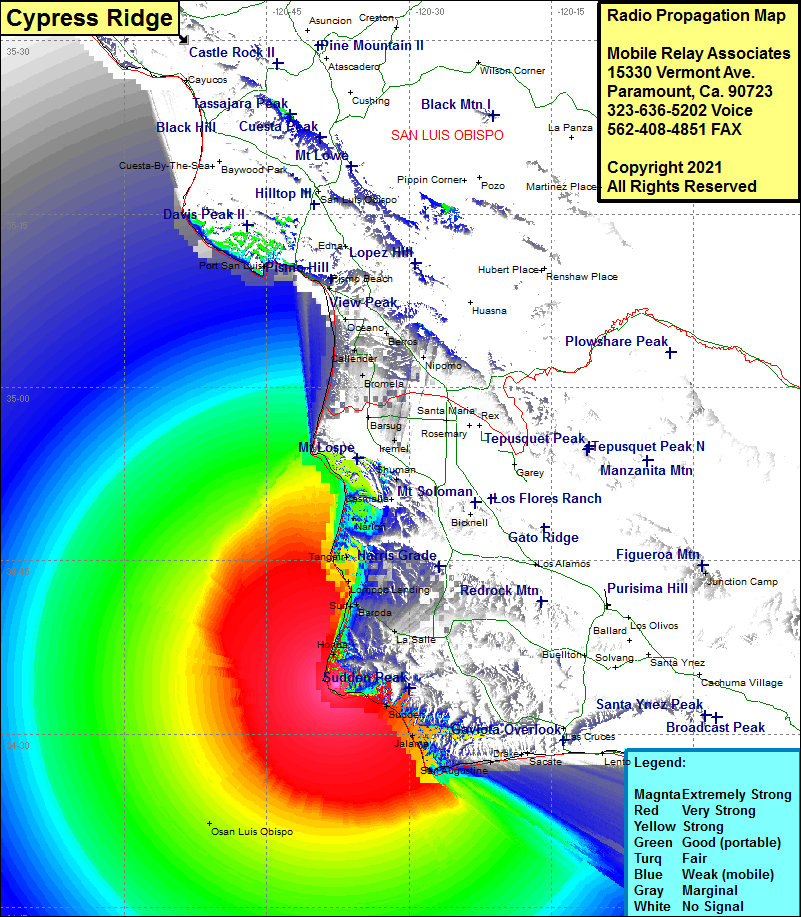 Cypress Ridge Coverage |
| Latitude: | 034 34 14.6N | 34.5707222 |
| Longitude: | 120 37 37.2W | -120.6270000 |
| Feet | Meters | |
| Ground Elevation: | 706.0 | 215.2 |
| HAAT: | 557.7 | 170.0 |
| City: | Lompoc | |
| County: | Santa Barbara | |
| State: | California |
This is not an MRA Owned Site. For space rental contact the site owner.
Do you own or manage this site? Click Here
Would you like to add a site to the Google Earth Map?? Click Here
Site Coverage: Coverage of Concepcion, San Augustine, Jalama, Sudden, Honda, Baroda, Surf, Lompoc Landing, Tangair, Narlon, Antonio, Bragur, Bromela, Nipomo, Callender
Amateur (ham) frequencies: