Daniels Peak
| Site Name: | Daniels Peak | 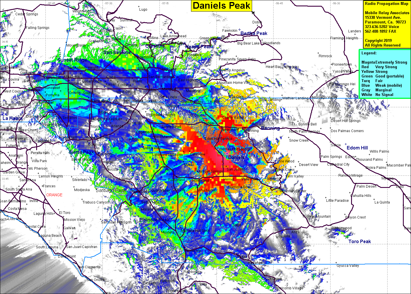 Daniels Peak Coverage |
| Latitude: | 033 49 49.2N | 33.8303333 |
| Longitude: | 116 57 14.3W | -116.9539722 |
| Feet | Meters | |
| Ground Elevation: | 3,727.0 | 1,136.0 |
| HAAT: | 1,547.5 | 471.7 |
| City: | Gillman Hot Springs | |
| County: | Riverside | |
| State: | California |
This is not an MRA Owned Site. For space rental contact the site owner.
Do you own or manage this site? Click Here
Would you like to add a site to the Google Earth Map?? Click Here
Site Coverage: Coverage of Hemet, Jan Jacinto, Winchester, Murietta, Edgemont, Moreno, Cherry Valley, Valle Vista, Lakeview, Banning, Beaumont, Hinda, Yicaipa, Calimesa
Amateur (ham) frequencies: