Davis Peak II
| Site Name: | Davis Peak II | 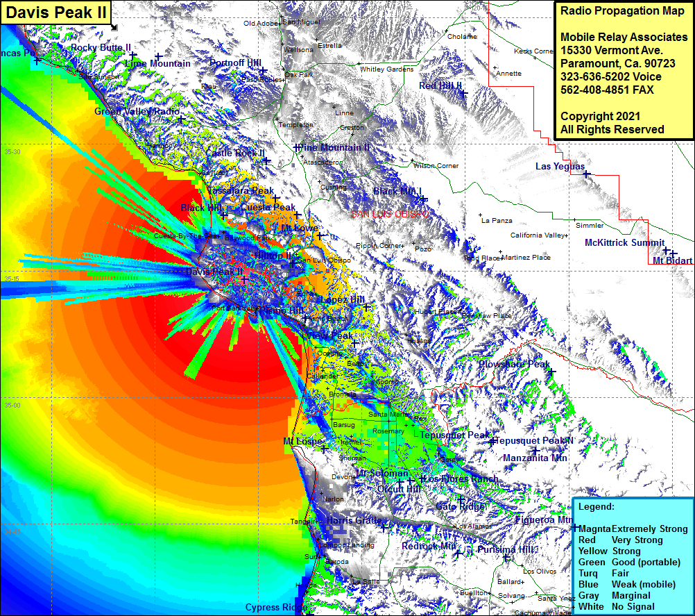 Davis Peak II Coverage |
| Latitude: | 035 13 59.2N | 35.2331111 |
| Longitude: | 120 47 04.3W | -120.7845278 |
| Feet | Meters | |
| Ground Elevation: | 1753.0 | 534.3 |
| HAAT: | 1474.7 | 449.5 |
| City: | Avila Beach | |
| County: | San Luis Obispo | |
| State: | California |
This is not an MRA Owned Site. For space rental contact the site owner.
Do you own or manage this site? Click Here
Would you like to add a site to the Google Earth Map?? Click Here
Site Coverage: Coverage of Los Osos, Baywood Park, Cuesta-By-The-Sea, Morro Bay, Cayucos, Harmony, Cambria, San Simeon, Thyle, Serrano, Chorro, Lan Luis Obispo, Edna, Tiber, Verde, Pismo Beach, Arroyo Grande, Oceano, Berros, Callender, Nipomo, Bromela, Barsug, Gum, Carr, Midco, North Santa Maria, Santa Maria, Rex, Garey, Sisquoc, Orcutt, Shuman, Waldorf, Narlon, Tangair, Lompoc Landing, Baroda, Surf, LaSalle, Honda
Amateur (ham) frequencies: