Diablo Peak
| Site Name: | Diablo Peak | 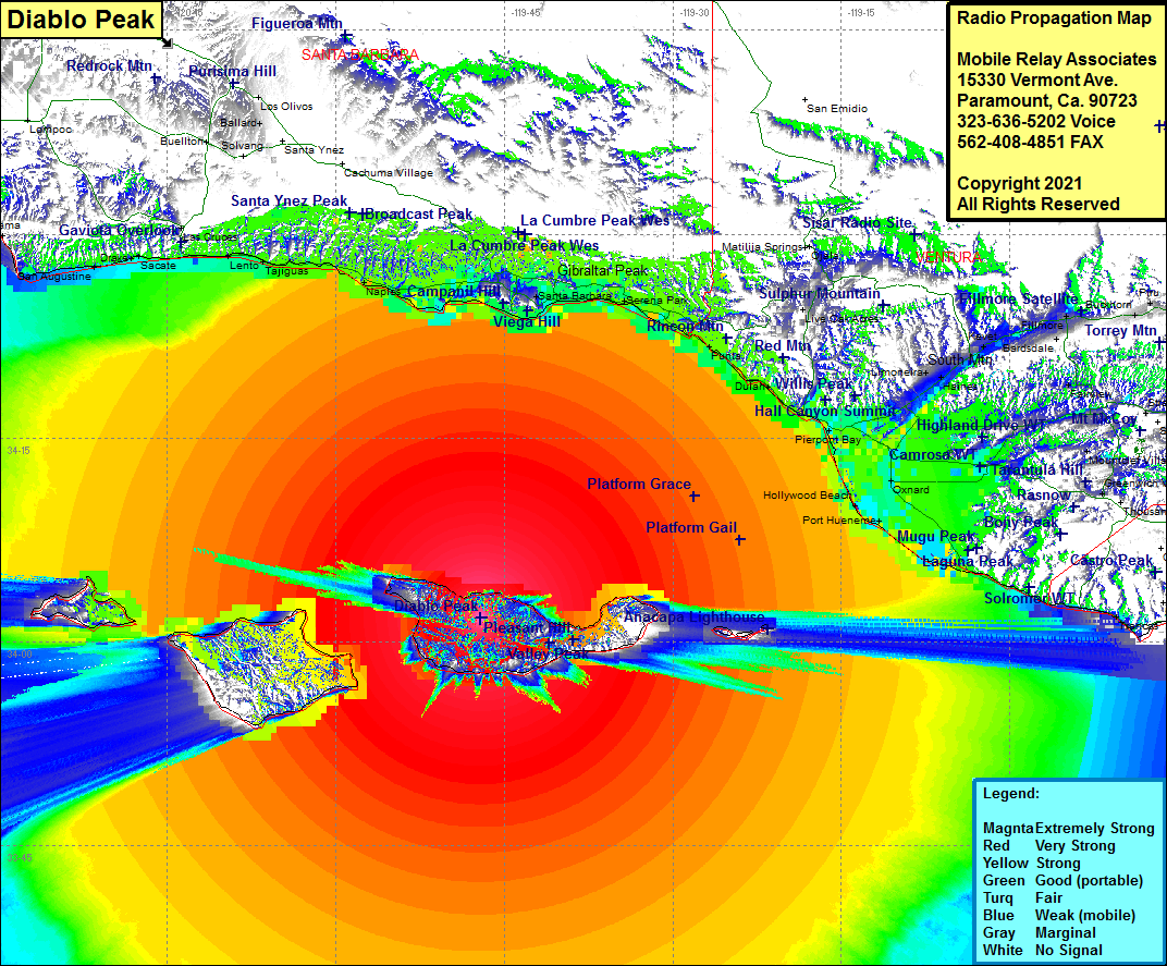 Diablo Peak Coverage |
| Latitude: | 034 01 45.0N | 34.0291667 |
| Longitude: | 119 47 04.0W | -119.7844444 |
| Feet | Meters | |
| Ground Elevation: | 2433.0 | 741.6 |
| HAAT: | 2294.8 | 699.5 |
| City: | Santa Cruz Island | |
| County: | Santa Barbara | |
| State: | California |
This is not an MRA Owned Site. For space rental contact the site owner.
Do you own or manage this site? Click Here
Would you like to add a site to the Google Earth Map?? Click Here
Site Coverage: Coverage of most of Santa Cruz Island, about 65% of Santa Rosa Island and about 50% of San Miguel Island, about 20% of Santa Barbara Island and about 50% of San Nicholas Island, Sudden, Concepcion, Gator, Drake, Sacate, Las Cruces, Lento, Capitan, Naples, Ellwood, Coromar, La Patera, El Sueno, Goleta, Santa Barbara, Montecito, Summerland, Serena, Serena Park, Old Town, Sandyland Cove, Carpinteria, Punta, Punta Gorda, Dulah, Ventura, Pierpoint Bay, Kimball, El Rio, Oxnard, Hollywood Beach, Port Hueneme, Solromer, Leesdale, Camarillo, West Saticoy, Springville, Limon, Haines, Limoneira, Santa Paula, Kevet, Oak Village, Sespe, Keith, Fillmore, Cavin, Buckhorn, Piru, Moorpark Home Acres, Moorpark, Virginia Colony, Mountclef Village, Greenwich Village, Platform Grace, Platform Gail
Amateur (ham) frequencies: