Double Mtn
| Site Name: | Double Mtn | 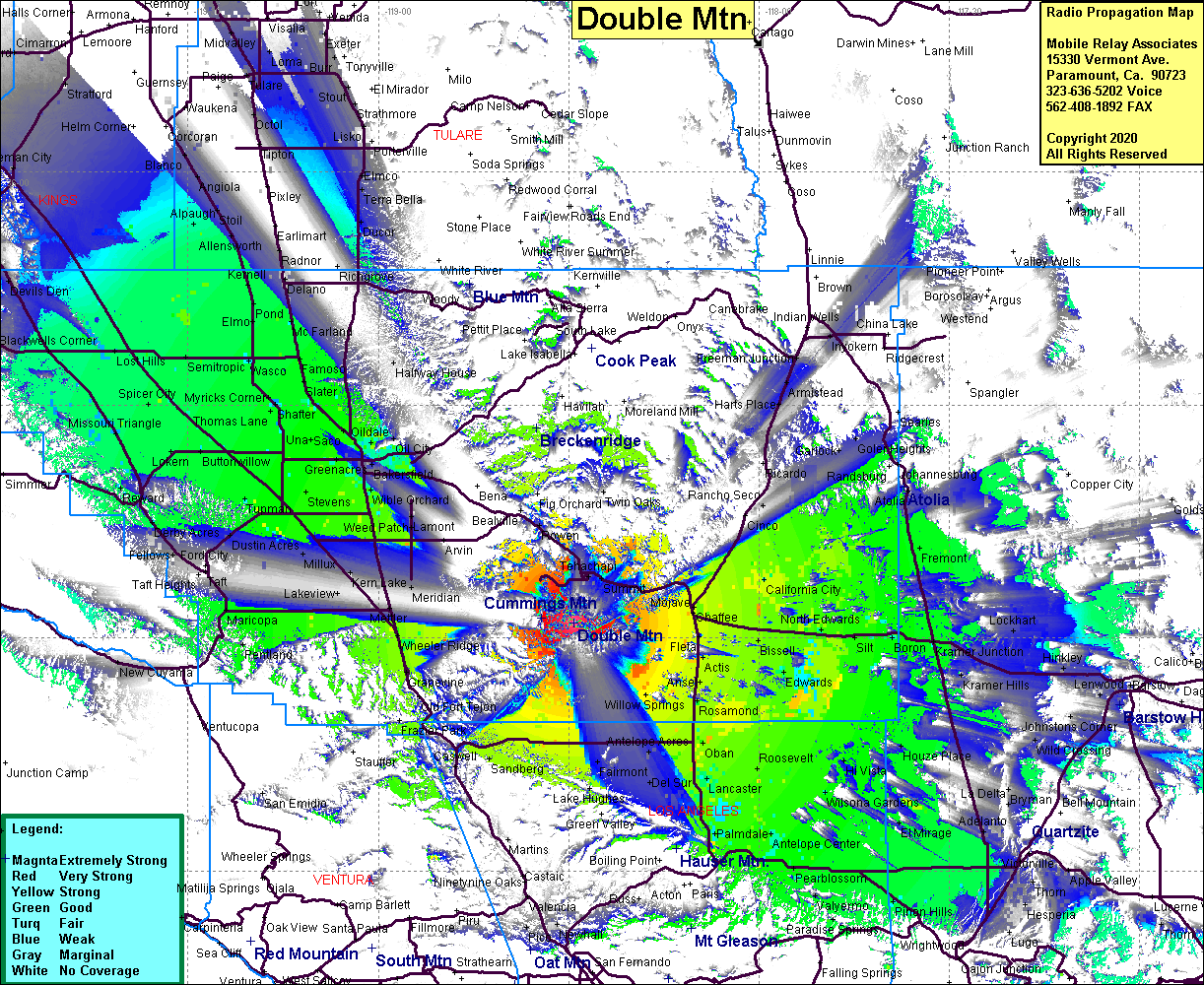 Double Mtn Coverage |
| Latitude: | 035 01 56.0N | 35.0322222 |
| Longitude: | 118 29 06.3W | -118.4850833 |
| Feet | Meters | |
| Ground Elevation: | 7982.3 | 2433.0 |
| HAAT: | 3257.3 | 992.8 |
| City: | Tehachapi | |
| County: | Kern | |
| State: | California |
This is not an MRA Owned Site. For space rental contact the site owner.
Do you own or manage this site? Click Here
Would you like to add a site to the Google Earth Map?? Click Here
Site Coverage: Coverage of the San Joaquin Valley from north of Bakersfield to Kettleman City, Tehachapi, Manolith, Cable, Five Points, Sanberg, Three Points, Palmdale, Lancaster, Rosamond, Roosevelt, Pearblossom, Pinon Hills, Hi Vista, Edwards, Aerial Acres, California City, Randsburg, Fremont, Boron, Kramer Jct, El Mirage, Wilsona Gardens, Antelope Center, MIle High, Four Points
Amateur (ham) frequencies: