Eagle Cyn Rd
| Site Name: | Eagle Cyn Rd | 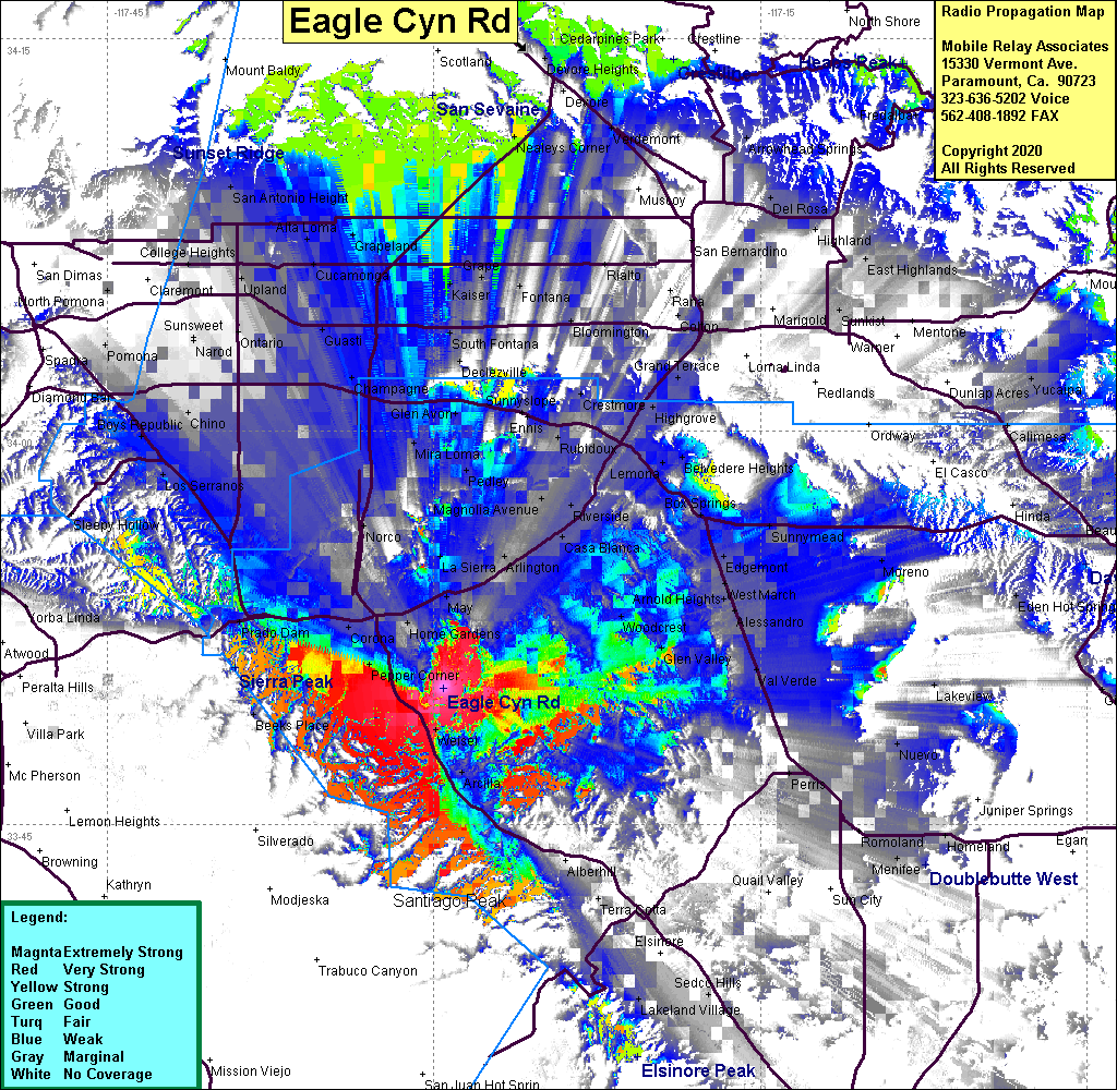 Eagle Cyn Rd Coverage |
| Latitude: | 033 50 12.1N | 33.8366944 |
| Longitude: | 117 29 34.5W | -117.4929167 |
| Feet | Meters | |
| Ground Elevation: | 1230.0 | 374.9 |
| HAAT: | -41.7 | -12.7 |
| City: | Corona | |
| County: | Riverside | |
| State: | California |
This is not an MRA Owned Site. For space rental contact the site owner.
Do you own or manage this site? Click Here
Would you like to add a site to the Google Earth Map?? Click Here
Site Coverage: Coverage of I15 from south of Corona to Weirick Rd, Arcilla, Weisel, El Cerrito, Pepper Corner
Amateur (ham) frequencies: