Easton
| Site Name: | Easton | 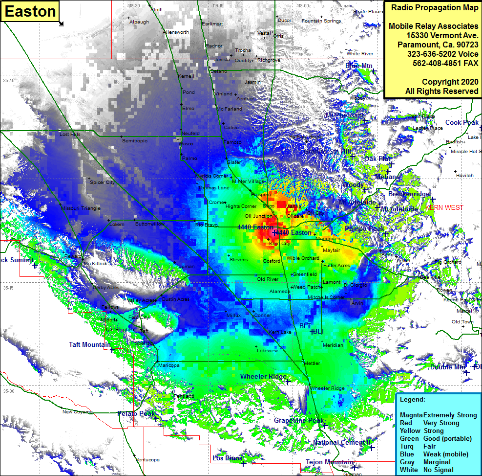 Easton Coverage |
| Latitude: | 035 22 13.5N | 35.3704167 |
| Longitude: | 119 03 09.2W | -119.0525556 |
| Feet | Meters | |
| Ground Elevation: | 400.0 | 121.9 |
| HAAT: | -218.2 | -66.5 |
| City: | Bakersfield | |
| County: | Kern | |
| State: | California |
This is not an MRA Owned Site. For space rental contact the site owner.
Do you own or manage this site? Click Here
Would you like to add a site to the Google Earth Map?? Click Here
Site Coverage: Coverage of Bakersfield, Saco, Prospero, Cawelo, Thomas Lane, Hights Corner, Rio Bravo, Stevens, Old Rivers, Greenfield, Weed Patch, Lamont, Meridian, Lakeview, Mettler, Wheeler Ridge, Maricopa, Millux, Lokern, Tupman, Semitropic, Elmo, Pond, Kernell, Missouri Triangle
Amateur (ham) frequencies: