Elk Hills II
| Site Name: | Elk Hills II | 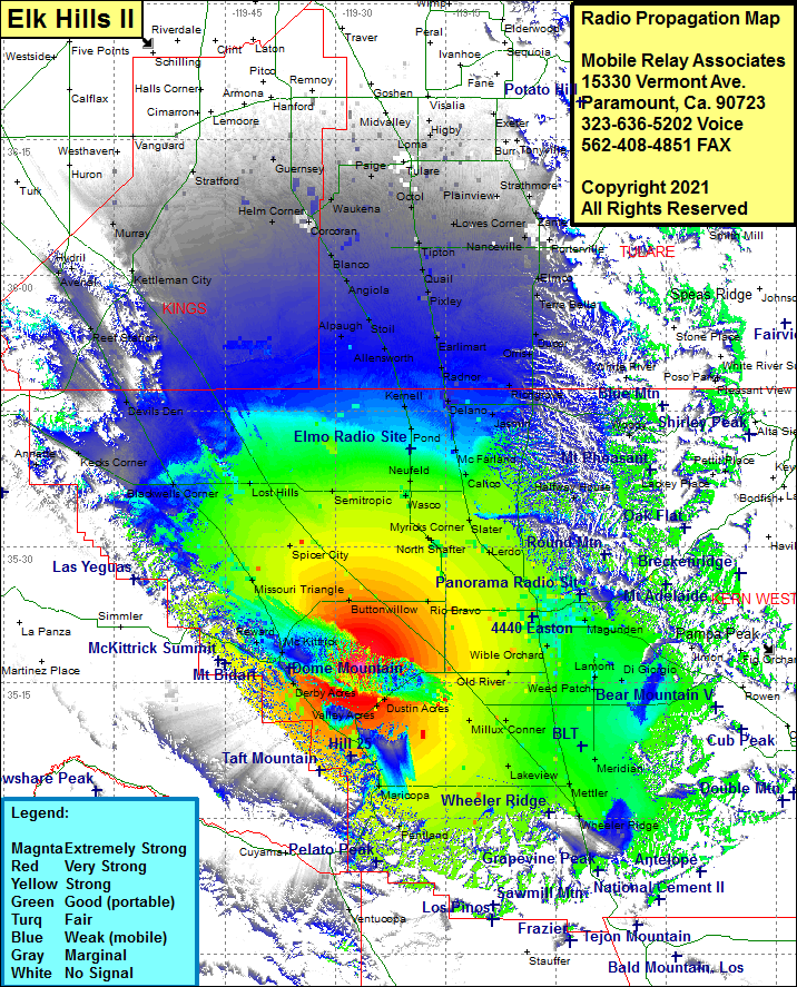 Elk Hills II Coverage |
| Latitude: | 035 16 40.8N | 35.2780000 |
| Longitude: | 119 26 37.4W | -119.4437222 |
| Feet | Meters | |
| Ground Elevation: | 1391.0 | 424.0 |
| HAAT: | 771.8 | 235.3 |
| City: | Tupman | |
| County: | Kern | |
| State: | California |
This is not an MRA Owned Site. For space rental contact the site owner.
Do you own or manage this site? Click Here
Would you like to add a site to the Google Earth Map?? Click Here
Site Coverage: Coverage of Reward, Annette, Kecks Corner, Blackwells Corner, Devils Den, Reef Station, Avenal, Hydril, Kettleman City, Murray, Lost Hills, Missouri Triangle, Spicer City, Semitropic, Helm Corner, Stratford, Guernsey, Helm Corner, Waukena, Paige, Corcoran, Blanco, Angiola, Stoil, Allensworth, Kernell, Pond, Elmo, Neufeld, Wasco, Palmo, Myricks Corner, Smith Corner, Hights Corner, Lokern, Buttonwillow, Rio Bravo, Tupman, Derby Acres, Lardo, Slater, Famoso, Calico, McFarland, Vinland, Jasmin, Delano, Jovista, Trocha, Vestal, Radnor, Earlimart, Pixley, Quail, Tipton, Octol, Swall, Tagus, Loma, List, Burr, Toolville, Tonyville, Cairns Corner, Stout, Plainview, Strathmore, Zante, Porterville, Poplar, Ponca, Magnolia, Elmco, Terra Bella, Ducor, Orris, Richgrove, White River, Fountain Springs, Woody, Kern City, Bakersfield, Edison, Wible Orchard, Gosford, Stevens, Old River, Weed Patch, Lamont, Meridian, Mettler, Wheeler Ridge, Lakeview, Kern Lake, Conner, Millun, Dustin Acres, Maricopa, Ford City, Spellacy
Amateur (ham) frequencies: