Encanto
| Site Name: | Encanto | 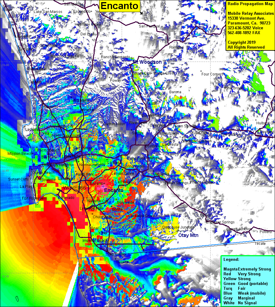 Encanto Coverage |
| Latitude: | 032 42 16.8N | 32.7046667 |
| Longitude: | 117 03 09.1W | -117.0525278 |
| Feet | Meters | |
| Ground Elevation: | 488.8 | 149.0 |
| HAAT: | 240.6 | 73.3 |
| City: | National City | |
| County: | San Diego | |
| State: | California |
This is not an MRA Owned Site. For space rental contact the site owner.
Do you own or manage this site? Click Here
Would you like to add a site to the Google Earth Map?? Click Here
Site Coverage: Coverage of Encanto, Normal Heights, San Diego, Imperial Beach, San Ysidro, Chula Vista, Lemon Grove, La Mesa, Serra Mesa, Sunnyside, Boal, Bonita
Amateur (ham) frequencies: