Figueroa Mtn
| Site Name: | Figueroa Mtn | 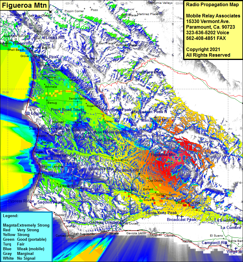 Figueroa Mtn Coverage |
| Latitude: | 034 44 36.2N | 34.7433889 |
| Longitude: | 119 59 05.7W | -119.9849167 |
| Feet | Meters | |
| Ground Elevation: | 4532.0 | 1381.4 |
| HAAT: | 2400.1 | 731.5 |
| City: | Los Olivos | |
| County: | Santa Barbara | |
| State: | California |
This is not an MRA Owned Site. For space rental contact the site owner.
Do you own or manage this site? Click Here
Would you like to add a site to the Google Earth Map?? Click Here
Site Coverage: Coverage of Junction Camp, Los Olivos, Ballard, Santa Ynez, Solvang, Buelton, Los Alamos, Lompoc, LaSalle, Baroda, Surf, Lompoc Landing, Tangair, Narlon, Antonio, Casmalia, Shuman, Orcutt, Garey, Rosemary, Santa Maria, Nipomo, Berros, Bromela, Barsug, Callender, Oceano, Grover City, Pismo Beach, Carr, Pacer, Midco, Bragur, Waldorf, Betteravia, Iremel, Huasna, Cachuma Village
Amateur (ham) frequencies: