Granite Station Hill
| Site Name: | Granite Station Hill | 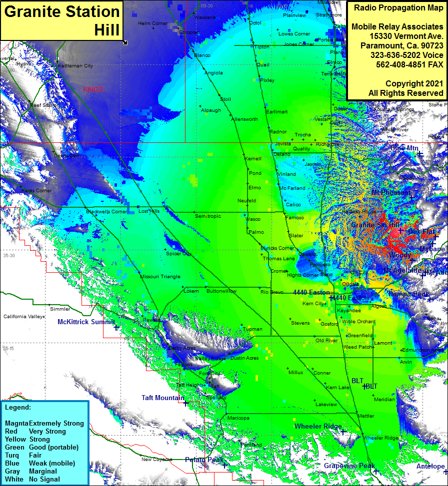 Granite Station Hill Coverage |
| Latitude: | 035 33 08.8N | 35.5524444 |
| Longitude: | 118 49 23.3W | -118.8231389 |
| Feet | Meters | |
| Ground Elevation: | 2695.0 | 821.4 |
| HAAT: | 702.1 | 214.0 |
| City: | North Woody | |
| County: | Kern | |
| State: | California |
This is not an MRA Owned Site. For space rental contact the site owner.
Do you own or manage this site? Click Here
Would you like to add a site to the Google Earth Map?? Click Here
Site Coverage: Coverage of the southern portion of the San Joaquin Valley, Bakersfield, Wheeler Ridge, Meridian, Lakeview, Millux, Conner, Maricopa, Dustin Acres, Lokern, Missouri Triangle, Blackwells Corner, Lost Hills, Tupman, Gosford, Kern City, Rio Bravo, Buttonwillow, Spicer Bay, Semitropic, Wasco, Palmo, Slater, Famoso, Calico, McFarland, Vinland, Delano Jovista, Radnor, Trocha, Westal, Earlimart, Pixley, Quail, Tipton, Angiola, Blanco, Octol, Lowes Corner, Plainview, Strathmore, Nanceville, Richgrove, Jasmin, Halfway House, Woody, Oil City, Oildale, Algoso, Bena, Petit Place
Amateur (ham) frequencies: