Grant Peak
| Site Name: | Grant Peak | 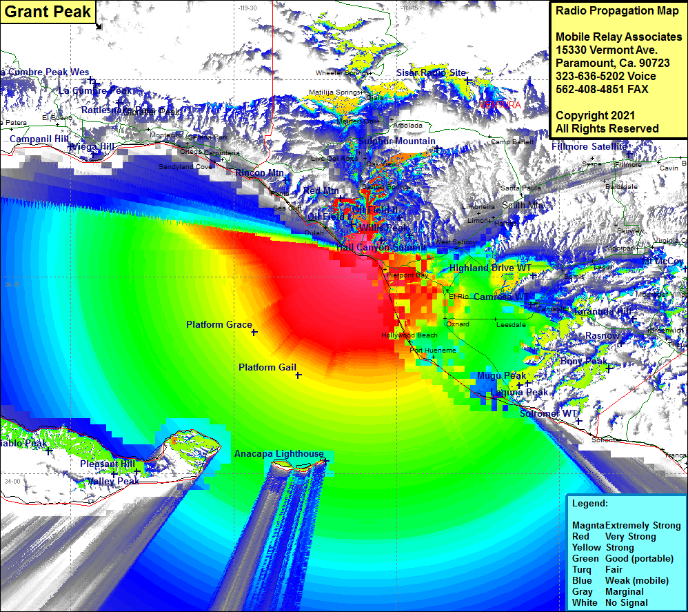 Grant Peak Coverage |
| Latitude: | 034 17 11.3N | 34.2864722 |
| Longitude: | 119 17 38.9W | -119.2941389 |
| Feet | Meters | |
| Ground Elevation: | 467.0 | 142.3 |
| HAAT: | 177.6 | 54.1 |
| City: | Ventura | |
| County: | Ventura | |
| State: | California |
This is not an MRA Owned Site. For space rental contact the site owner.
Do you own or manage this site? Click Here
Would you like to add a site to the Google Earth Map?? Click Here
Site Coverage: Coverage of Ventura, Dulah, Sea Cliff, Punta Gorda, Punta, Sandyland Cove, Serena, Ortega, Summerland, Montecito, Santa Barbara, Wadstrom, Ortonville, Weldons, Casitas Springs, Oak View, Live Oak Acres, Mira Monte, Meiners Oak, Arbolade, Ojala, Pierpont Bay, Montalvo, Kimball, El Rio, Nyland, Oxnard, West Saticoy, Springville, Leesdale, Somis, Lagol, Camarillo, Mountclef Village, Newbury Park, Greenwich Village, Bardsdale, Limon, Haines, Kevet, Oak Village, Keith, Sespe, Port Hueneme, Silver Strand, Hollywood By The Sea, Hollywood Beach, Anacapa Island, northern shore of Santa Cruz Island
Amateur (ham) frequencies: