Hall Canyon Summit
| Site Name: | Hall Canyon Summit | 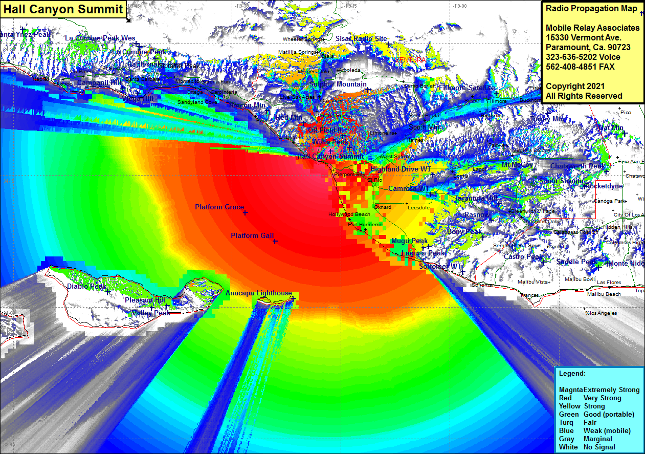 Hall Canyon Summit Coverage |
| Latitude: | 034 17 47.0N | 34.2963889 |
| Longitude: | 119 16 24.6W | -119.2735000 |
| Feet | Meters | |
| Ground Elevation: | 1158.0 | 353.0 |
| HAAT: | 767.9 | 234.1 |
| City: | Ventura | |
| County: | Ventura | |
| State: | California |
This is not an MRA Owned Site. For space rental contact the site owner.
Do you own or manage this site? Click Here
Would you like to add a site to the Google Earth Map?? Click Here
Site Coverage: Coverage of Ventura, Dulah, Sea Cliff, Punta Gorda, Punta, Carpenteria, Old Town, Wadstrom, Ortonville, Weldons, Casitas Springs, Oak View, Live Oak Acres, Monte, Meiners Oak, Artolada, Sandyland Cove, Serena, Summerland, Montecito, Santa Barbara, El Sueno, La Putera, Coromar, Ellwood, Naples, Ojala, Montalvo, Kimball, West Saticoy, Limon, Limoneira, Haines, Santa Paula, Kevet, Keith, Oak Village, Sespe, Fillmore, Bardsdale, Cavin, Fairview, Epworth, Moorpark, Virginia Colony, Stathearn, Simi, Community Center, Santa Susana, Moorpark, Moorpark Home Acres, Lagol, Mountclef Village, Grenwich Village, Thousand Oaks, Triunfo Corner, Newbury Park, Leesdale, Port Hueneme, Silver Strand, Hollywood By The Sea, Hollywood Beach, Oxnard, El Rio, Nyland, Springville
Amateur (ham) frequencies: