Hauser Mtn
| Site Name: | Hauser Mtn | 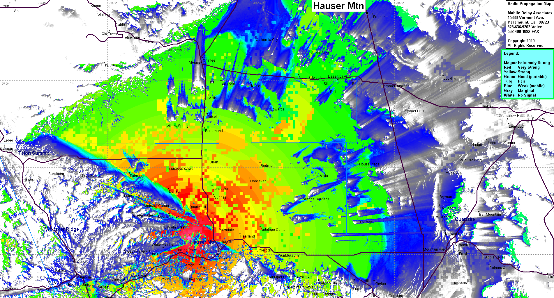 Hauser Mtn Coverage |
| Latitude: | 034 32 50.0N | 34.5472222 |
| Longitude: | 118 12 57.0W | -118.2158333 |
| Feet | Meters | |
| Ground Elevation: | 5,203.4 | 1,586.0 |
| HAAT: | 2,146.5 | 654.2 |
| City: | Palmdale | |
| County: | Los Angeles | |
| State: | California |
This is not an MRA Owned Site. For space rental contact the site owner.
Do you own or manage this site? Click Here
Would you like to add a site to the Google Earth Map?? Click Here
Site Coverage: Coverage of the high desert, Palmdale, Lancaster, Hwy14, Rosamond, Willow Springs, Edwards, California City, El Mirage
Amateur (ham) frequencies: