Hill 25
| Site Name: | Hill 25 | 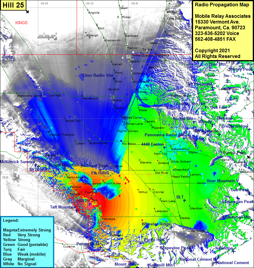 Hill 25 Coverage |
| Latitude: | 035 06 54.2N | 35.1150556 |
| Longitude: | 119 27 51.7W | -119.4643611 |
| Feet | Meters | |
| Ground Elevation: | 1673.0 | 509.9 |
| HAAT: | 280.0 | 85.3 |
| City: | Taft | |
| County: | Kern | |
| State: | California |
This is not an MRA Owned Site. For space rental contact the site owner.
Do you own or manage this site? Click Here
Would you like to add a site to the Google Earth Map?? Click Here
Site Coverage: Coverage of Ford City, Taft, Maricopa, Fellows, Derby Acres, Spellacy, Reward, Spicer City, Lost Hills, Semitroic, Lokern, Tupman, Buttonwillow, Rio Bravo, Hights Corner, Thomas Lane, Myricks Corner, Palmo, Wasco, Newfeld, Elmo, Pond, Kernell, Allensworth, Stoil, Alpaugh, Blackwells Corner, Earlimart, Radnor, Jovista, Delano, Vinland, McFarland, Calico, Famoso, Slater, Caswelo, Propero, Bakersfield, Zentner, Jasmin, Quality, Trocha, Richgrove, Vestal, Orris, Ducor, Halfway House, Magurden, Wible Orchard, Greenfield, Weed Patch, Fuller Acres, DiGiorgio, Arvin, Meridian, Mettler, Wheeler Ridge, Lakeview, Kern Lake, Conner, Millux, Old River, Gosford, Kern City, Rio Bravo
Amateur (ham) frequencies: