Horse Peak
| Site Name: | Horse Peak | 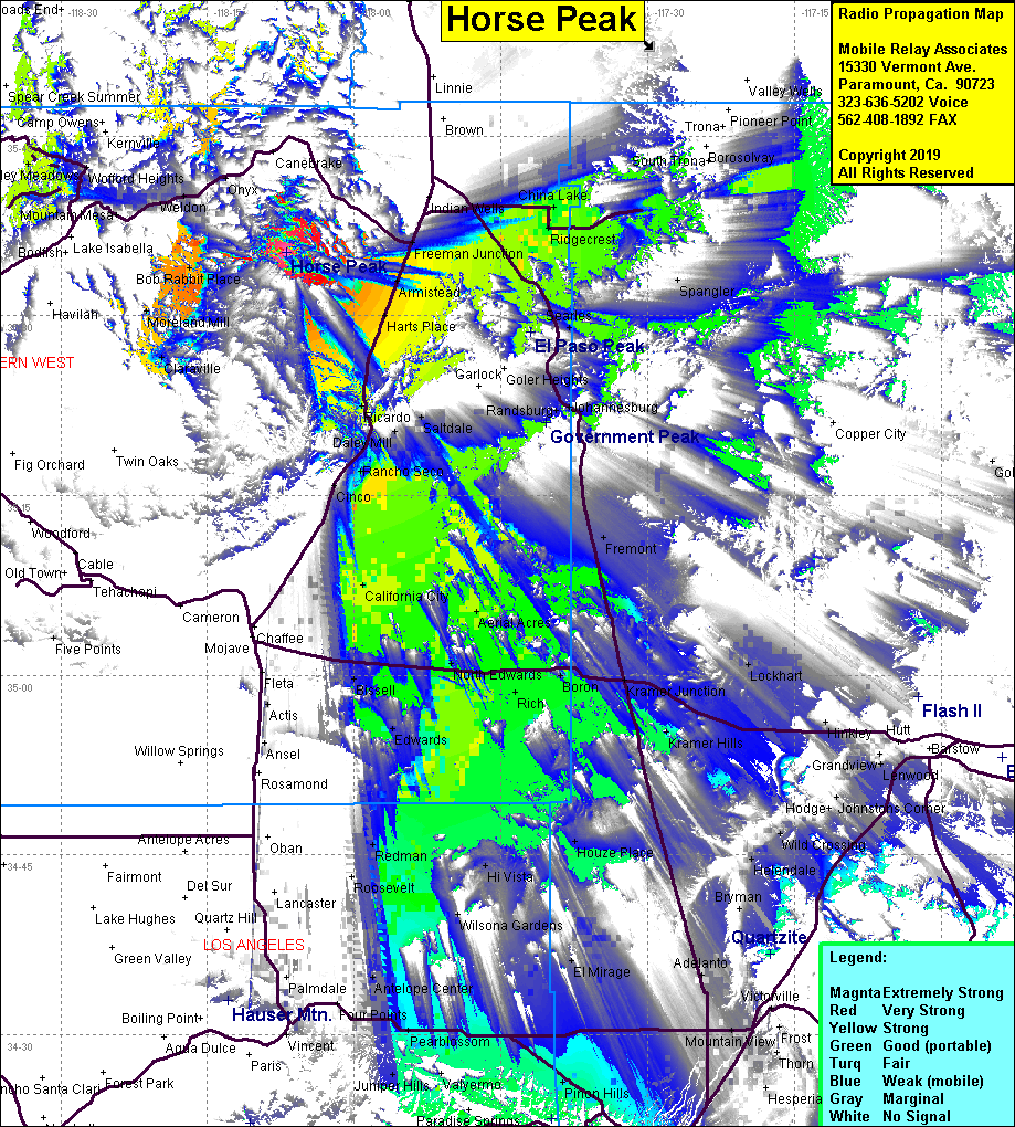 Horse Peak Coverage |
| Latitude: | 035 35 15.1N | 35.5875278 |
| Longitude: | 118 06 55.5W | -118.1154167 |
| Feet | Meters | |
| Ground Elevation: | 6,614.2 | 2,016.0 |
| HAAT: | 1,921.7 | 585.7 |
| City: | Inyokern | |
| County: | Kern | |
| State: | California |
This is not an MRA Owned Site. For space rental contact the site owner.
Do you own or manage this site? Click Here
Would you like to add a site to the Google Earth Map?? Click Here
Site Coverage: Coverage of Bob Rabbit place, Moreland Mill, Armistead, Harts Palce, Freeman Jct, Rancho Secom California City, North Edwards, Boron, Ridgecrest, China Lake
Amateur (ham) frequencies: