Hot Springs Mtn
| Site Name: | Hot Springs Mtn | 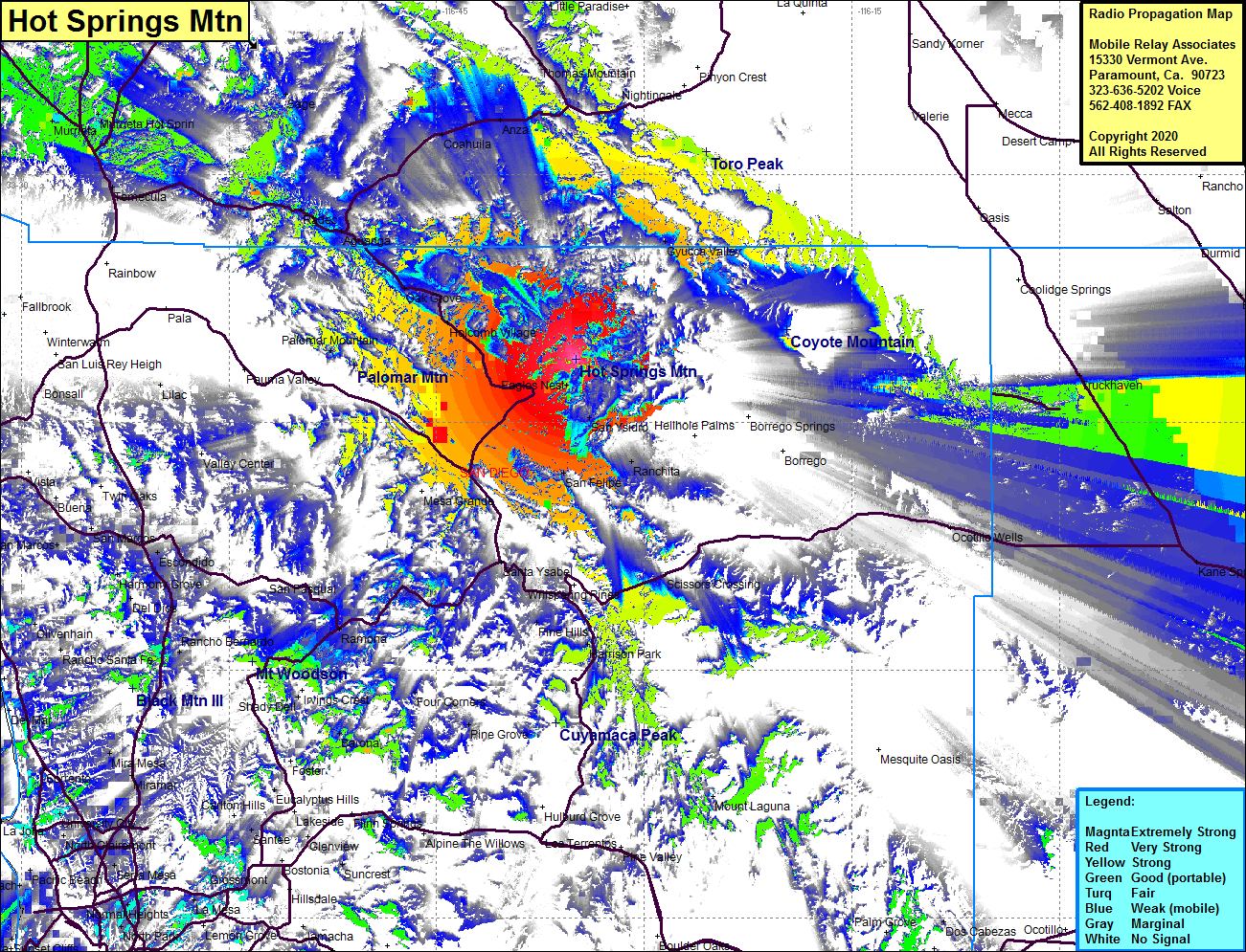 Hot Springs Mtn Coverage |
| Latitude: | 033 18 51.1N | 33.3141944 |
| Longitude: | 116 34 56.1W | -116.5822500 |
| Feet | Meters | |
| Ground Elevation: | 6494 | 1979.4 |
| HAAT: | 2581.0 | 786.69 |
| City: | San Ysidro | |
| County: | San Diego | |
| State: | California |
This is not an MRA Owned Site. For space rental contact the site owner.
Do you own or manage this site? Click Here
Would you like to add a site to the Google Earth Map?? Click Here
Site Coverage: Coverage of the northcentral portion of San Diego County including San Ysidro, Ranchito, Santa Ysabel, Oak Grove, Gyucca Valley, Radec, Coahuila, Anza, Sage, Murrieta, Murrieta Hot Springs, Winchester, Homeland, Thomas Mountain, Truckhaven, Ocotillo Wells, Kane Springs, Westmorland, Brawley, Rockwood, Fondo, Verdant, Calipatria, Estelle, Niland, Mundo, Wister, Iris, Niland, Tortuga, Amos, Glasgow, Glamis, Ruthven, Wiest, Curlew, Sandia, Fuller, Rico, Holtville, Imperial
Amateur (ham) frequencies: