KCEL-FM
| Site Name: | KCEL-FM | 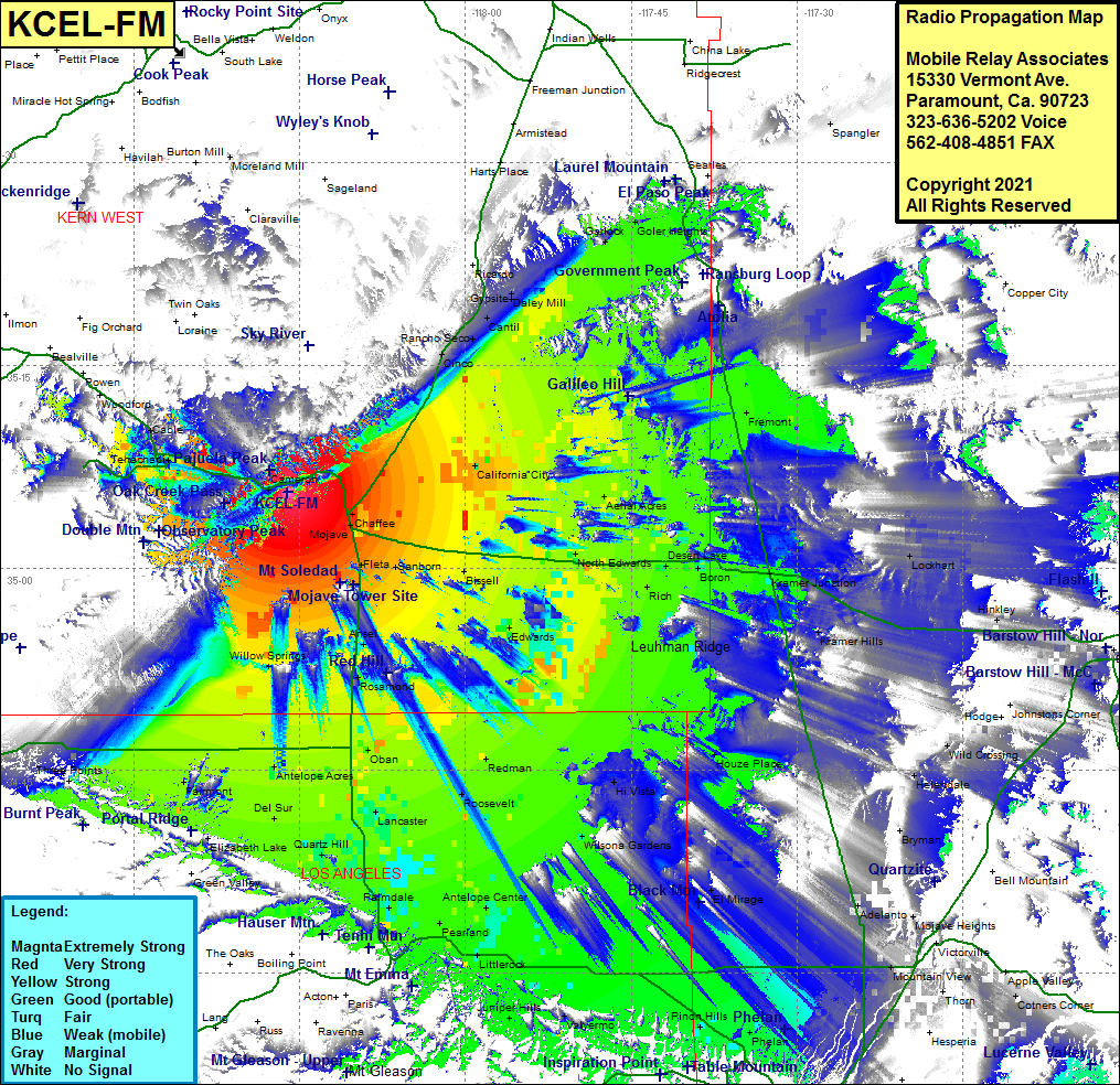 KCEL-FM Coverage |
| Latitude: | 035 05 38.0N | 35.0938889 |
| Longitude: | 118 16 03.4W | -118.2676111 |
| Feet | Meters | |
| Ground Elevation: | 4694.0 | 1430.7 |
| HAAT: | 819.4 | 249.8 |
| City: | Cameron | |
| County: | Kern | |
| State: | California |
This is not an MRA Owned Site. For space rental contact the site owner.
Do you own or manage this site? Click Here
Would you like to add a site to the Google Earth Map?? Click Here
Site Coverage: Coverage of Cameron, Manolith, Monolith, Summit, Tehachapi, Cable, Mojave, Chaffee, Fleta, Sanborn, Bissell, Actis, Ansel, Rosamond, Edwards, California City, North Edwards, Desert Lake, Boron, Kramer Junction, Kramer Hills, Fremont, Goler, Garlock, Daley Mill, Cantil, Cinco, Rancho Seco, Gypsite, Ricardo, Spangler, Lockhart, Hinkley, Houze Place, Wilsona Gardens, Hi Vista, Redman, Roosevelt, Oban, Lancaster, Palmdale, Pearland, Antelope Center, Juniper Hills, Valyermo, Pinon Hills, Phelan, Littlerock, Pearblossom, El Mirage, Mountain View, Adelanto, Helendale, Wild Crossing, Antelope Acres, Quartz Hill, Del Sur, Fairmot
Amateur (ham) frequencies: