Lane Mtn
| Site Name: | Lane Mtn | 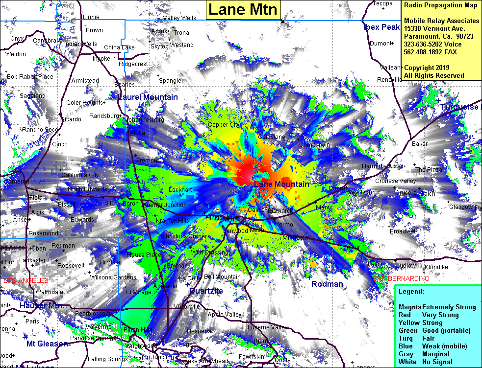 Lane Mtn Coverage |
| Latitude: | 035 05 25.9N | 35.0905278 |
| Longitude: | 116 56 22.1W | -116.9394722 |
| Feet | Meters | |
| Ground Elevation: | 4445.5 | 1355.0 |
| HAAT: | 1452.2 | 442.6 |
| City: | Barstow | |
| County: | San Bernardino | |
| State: | California |
This is not an MRA Owned Site. For space rental contact the site owner.
Do you own or manage this site? Click Here
Would you like to add a site to the Google Earth Map?? Click Here
Site Coverage: Coverage of Copper City, Goldstone, Manix, Harvard, Yermo, Dunn, Grandview, Lenwood, Barstow, Kramer Jct, Kramer Hills, Boron, Houze Place, Hi Vista, Adelanto, Bryman, Helendale, Wild Crossing, Hodge, Johnsons Corner, Nebo, Daggett, Minneola, Newberry Springs, Hector, Hinkley, Lockhart, Hesperia
Amateur (ham) frequencies: