Laurel Mtn
| Site Name: | Laurel Mtn | 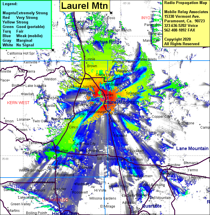 Laurel Mtn Coverage |
| Latitude: | 035 28 46.6N | 35.4796111 |
| Longitude: | 117 40 56.4W | -117.6823333 |
| Feet | Meters | |
| Ground Elevation: | 4435.7 | 1352.0 |
| HAAT: | 1345.4 | 410.1 |
| City: | Inyokern | |
| County: | Kern | |
| State: | California |
This is not an MRA Owned Site. For space rental contact the site owner.
Do you own or manage this site? Click Here
Would you like to add a site to the Google Earth Map?? Click Here
Site Coverage: Coverage of Freeman Jct, Ridgecrest, China Lake, South Trona, Trona, Pioneer Point, Valley Wells, Spangler, Randsburg, Johannesburg, Searles, Goler Heights, Garlock, Saltdale, Dale Mill, Rancho Seco, Cinco, Mojave, Chaffee, Oban, Redman, Kramer Jct, Kramer Hills, Rich, Aerial Acres, California City, Fremont, Atolia
Amateur (ham) frequencies: