Lodge Hill WT
| Site Name: | Lodge Hill WT | 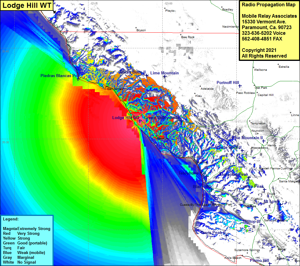 Lodge Hill WT Coverage |
| Latitude: | 035 32 58.0N | 35.5494444 |
| Longitude: | 121 04 33.1W | -121.0758611 |
| Feet | Meters | |
| Ground Elevation: | 441.0 | 134.4 |
| HAAT: | 51.3 | 15.6 |
| City: | Cambria | |
| County: | San Luis Obispo | |
| State: | California |
This is not an MRA Owned Site. For space rental contact the site owner.
Do you own or manage this site? Click Here
Would you like to add a site to the Google Earth Map?? Click Here
Site Coverage: Coverage of Cambria, Harmony, Cayucos, Cuesta-By-The-Sea, Baywood Park, San Simeon, California Highway 1 from just south of Gorda to California Highway 41, California Highway 46 from Highway 1 to Green Valley Viewing Point
Amateur (ham) frequencies: