Lopez Hill
| Site Name: | Lopez Hill | 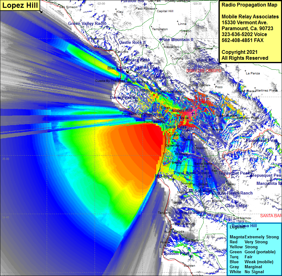 Lopez Hill Coverage |
| Latitude: | 035 10 43.7N | 35.1788056 |
| Longitude: | 120 29 21.3W | -120.4892500 |
| Feet | Meters | |
| Ground Elevation: | 1474.0 | 449.3 |
| HAAT: | 606.6 | 184.9 |
| City: | Arroyo Grande | |
| County: | San Luis Obispo | |
| State: | California |
This is not an MRA Owned Site. For space rental contact the site owner.
Do you own or manage this site? Click Here
Would you like to add a site to the Google Earth Map?? Click Here
Site Coverage: Coverage of Verde, Edna, Tiber, Huasna, Hubert Place, Renshaw Place, Nipomo, Santa Maria, Midco, Pacer, Barsub, Bragur, Waldorf, Shuman, Orcutt, Casmalia, Antonio, La Salle, Tangair, Lompoc Landing, Surf, Baroda, Bromela, Cattender, Berros, Oceano, Grover Sity, Pismo Beach, Shell Beach, Sycamore Springs, Avila Beach, San Luis Obispo, Cuesta-By-The-Sea, Baywood Park, Chorro, Thyle, Rhonda
Amateur (ham) frequencies: