Magic Mountain
| Site Name: | Magic Mountain | 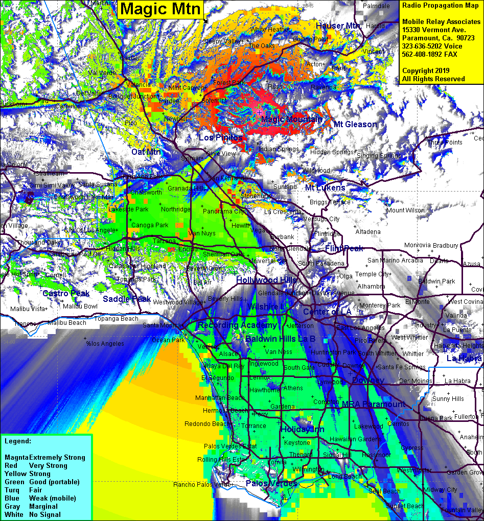 Magic Mountain Coverage |
| Latitude: | 034 23 10.2N | 34.3861667 |
| Longitude: | 118 19 45.4W | -118.3292778 |
| Feet | Meters | |
| Ground Elevation: | 4,867.1 | 1,483.5 |
| HAAT: | 2,271.8 | 692.4 |
| City: | Sylmar | |
| County: | Los Angeles | |
| State: | California |
This is not an MRA Owned Site. For space rental contact the site owner.
Do you own or manage this site? Click Here
Would you like to add a site to the Google Earth Map?? Click Here
Site Coverage: Coverage of Canyon Country, Hwy 5 from north of Hwy14 to 10 miles north of Castaic, Hwy14 north to Acton, San Fernando Valley, LA Basin, northwest Orange County
Amateur (ham) frequencies: