Marshall Peak
| Site Name: | Marshall Peak | 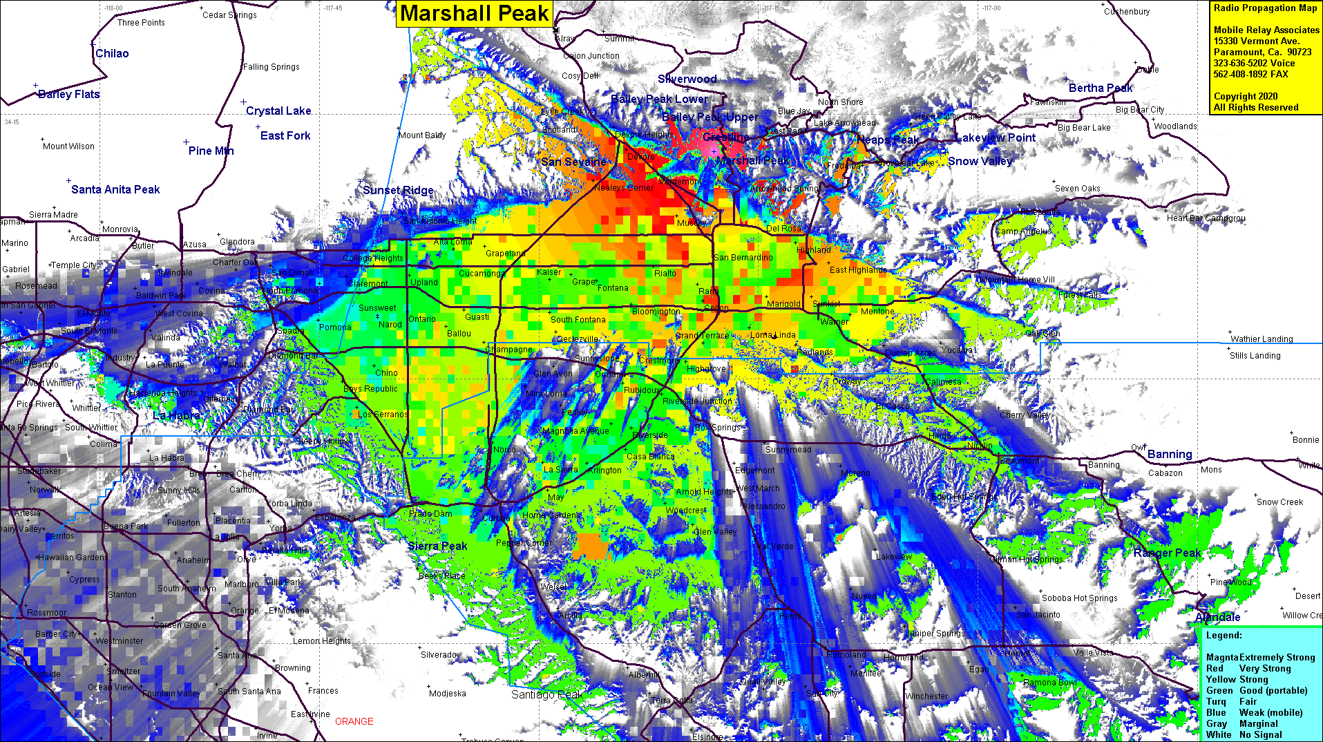 Marshall Peak Coverage |
| Latitude: | 034 12 53.1N | 34.2147500 |
| Longitude: | 117 18 01.3W | -117.3003611 |
| Feet | Meters | |
| Ground Elevation: | 4123.0 | 1256.7 |
| HAAT: | 1176.5 | 358.6 |
| City: | Crestline | |
| County: | San Bernardino | |
| State: | California |
This is not an MRA Owned Site. For space rental contact the site owner.
Do you own or manage this site? Click Here
Would you like to add a site to the Google Earth Map?? Click Here
Site Coverage: Coverage of Devore, Nealeys Corner, Crestline, San Bernardino, Pomona, Norco, Bryn Mawr, Loma Linda, Redlands, Inland Empire
Amateur (ham) frequencies: