MCI Tower
| Site Name: | MCI Tower | 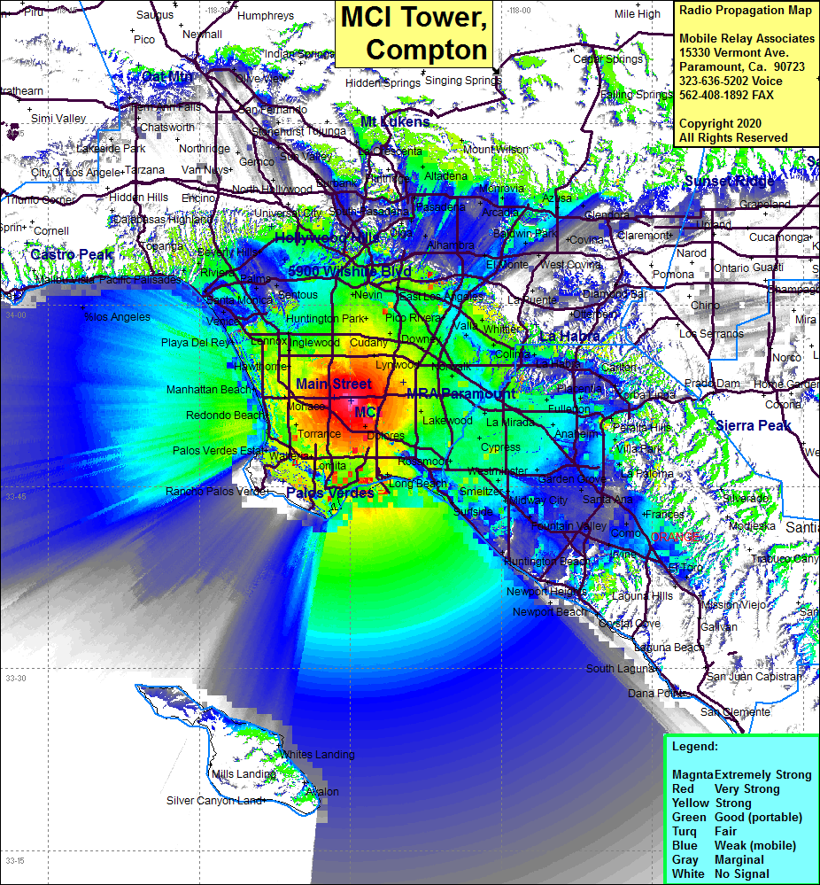 MCI Tower Coverage |
| Latitude: | 033 52 07.0N | 33.8686111 |
| Longitude: | 118 14 53.2W | -118.2481111 |
| Feet | Meters | |
| Ground Elevation: | 155.0 | 47.3 |
| HAAT: | 229.7 | 70.0 |
| City: | Compton | |
| County: | Los Angeles | |
| State: | California |
This is not an MRA Owned Site. For space rental contact the site owner.
Do you own or manage this site? Click Here
Would you like to add a site to the Google Earth Map?? Click Here
Site Coverage: Coverage of Compton, Dominguez Hills, Bixby Knolls, Signal Hill, San Pedro, Lomita, Walteria, Rolling Hills, Rolling Hills Estates, Palos Verdes Estates, Redondo Beach, Manhattan Beach, El Segundo, Hawthorne, Athens, Lennox, Inglewood, Westchester, South Gate, Los Angeles, Vernon, Maywood, East Los Angeles, Bandini, Downey, Hollydale, Artesia, Lakewood, Long Beach, San Pedro, Belmont Shores, Westminster, Stanton, Buena Park, Fullerton, Buena Park, South Whittier, Montebello, West Hollywood, Windsor Hills, Cienega
Amateur (ham) frequencies: