McKittrick Summit
| Site Name: | McKittrick Summit | 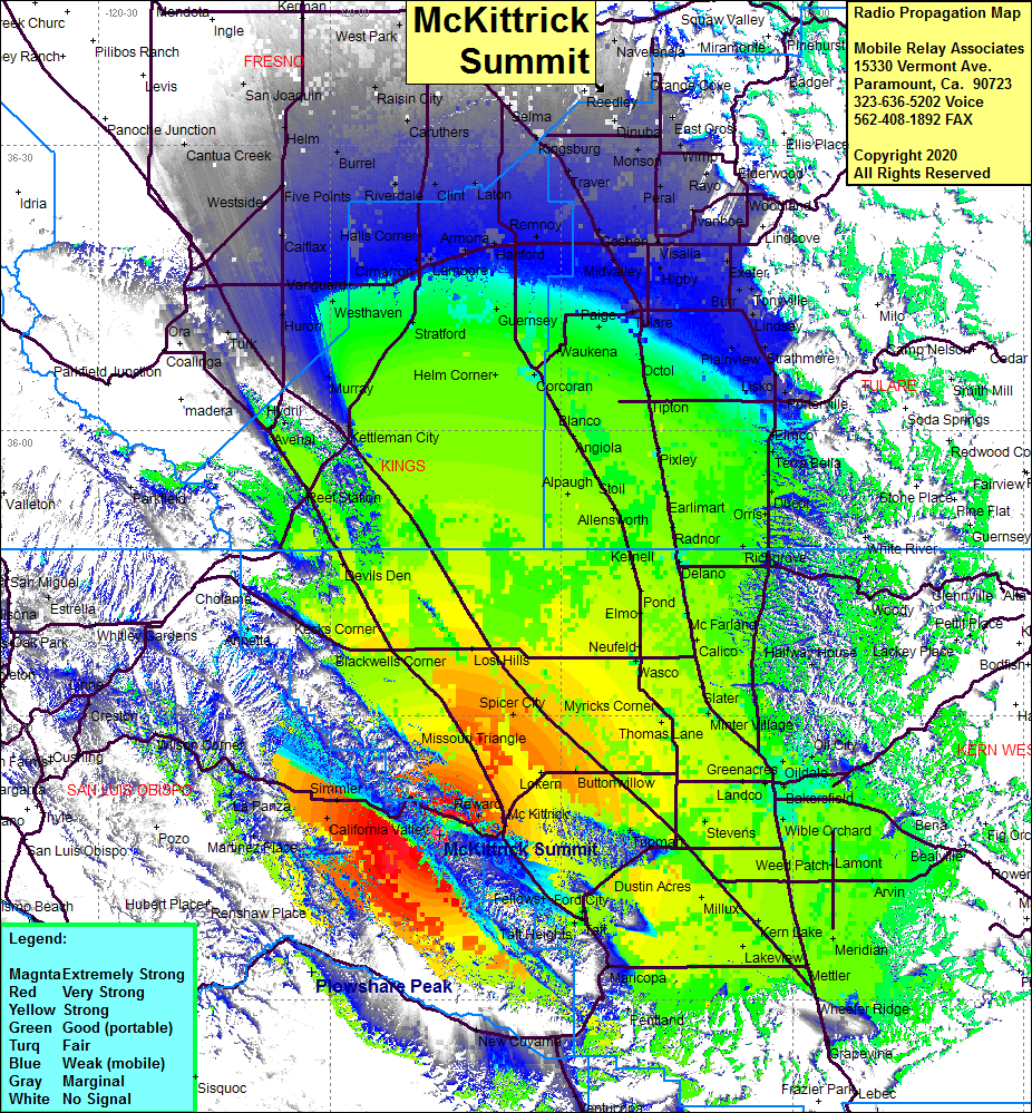 McKittrick Summit Coverage |
| Latitude: | 035 17 26.9N | 35.2908056 |
| Longitude: | 119 45 51.5W | -119.7643056 |
| Feet | Meters | |
| Ground Elevation: | 4318.9 | 1316.4 |
| HAAT: | 2176.6 | 663.4 |
| City: | McKittrick | |
| County: | Kern | |
| State: | California |
This is not an MRA Owned Site. For space rental contact the site owner.
Do you own or manage this site? Click Here
Would you like to add a site to the Google Earth Map?? Click Here
Site Coverage: Coverage of McKittrick, California Valley, Simmler, Hwy 58 from McKittrick west to Wilson Corner
Amateur (ham) frequencies: