Mebane
| Site Name: | Mebane | 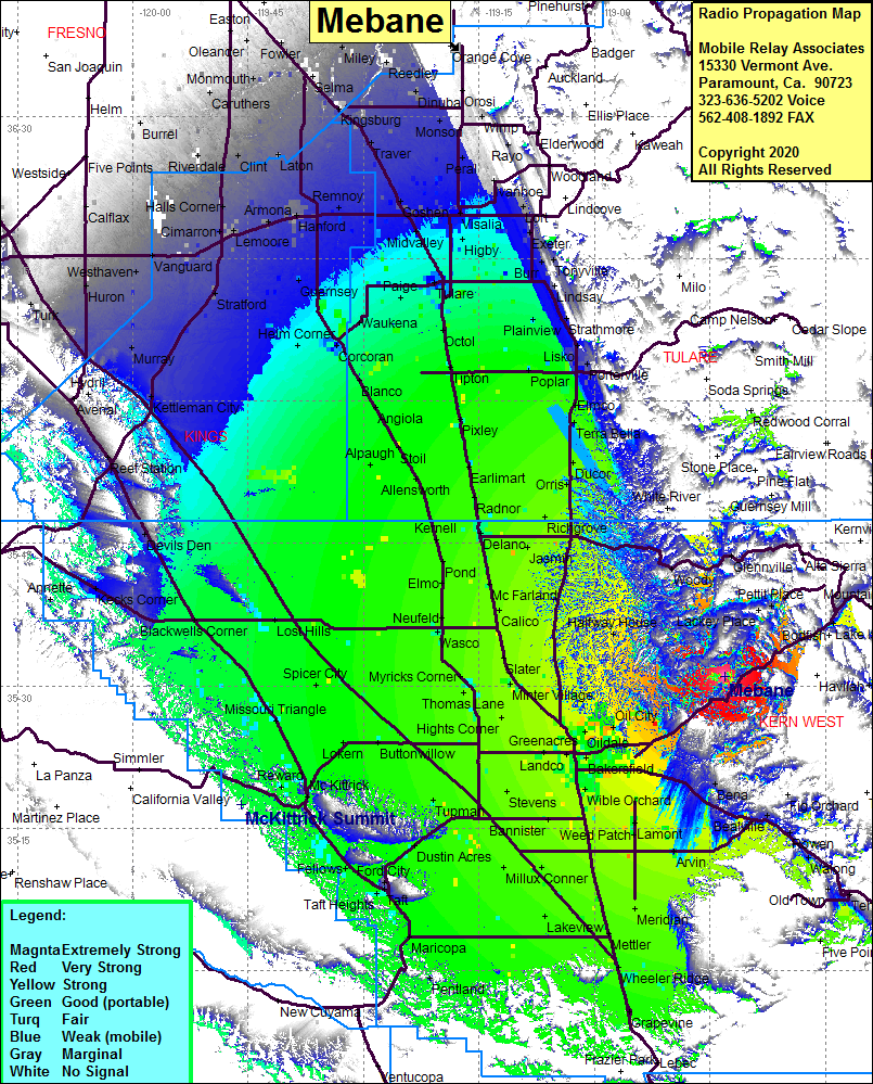 Mebane Coverage |
| Latitude: | 035 30 57.3N | 35.5159167 |
| Longitude: | 118 43 03.8W | -118.7177222 |
| Feet | Meters | |
| Ground Elevation: | 4481.0 | 1365.8 |
| HAAT: | 1467.1 | 447.2 |
| City: | Havilah | |
| County: | Kern | |
| State: | California |
This is not an MRA Owned Site. For space rental contact the site owner.
Do you own or manage this site? Click Here
Would you like to add a site to the Google Earth Map?? Click Here
Site Coverage: Coverage of the San Joaquin Valley south to Grapevine and north to Fowler, Glenville, Woody, Halfway House, Oil City, Oildale, Maltha, Edison, Lonsmith, DiGiorgio, Pettit Place, Lake Isabella, Bakersfield
Amateur (ham) frequencies: