Met Tower
| Site Name: | Met Tower | 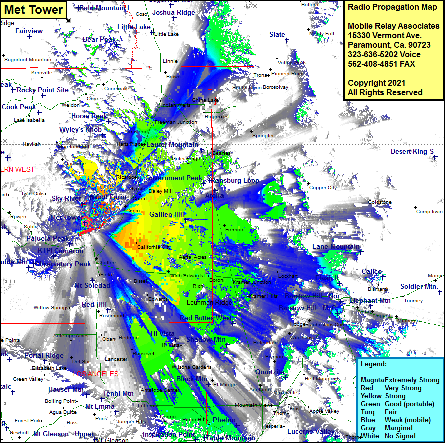 Met Tower Coverage |
| Latitude: | 035 12 01.9N | 35.2005278 |
| Longitude: | 118 13 40.4W | -118.2278889 |
| Feet | Meters | |
| Ground Elevation: | 5917.0 | 1803.5 |
| HAAT: | 1780.4 | 542.7 |
| City: | Warren | |
| County: | Kern | |
| State: | California |
This is not an MRA Owned Site. For space rental contact the site owner.
Do you own or manage this site? Click Here
Would you like to add a site to the Google Earth Map?? Click Here
Site Coverage: Coverage of Indian Wells, Freeman Junction, Armistead, Harts Place, Ricardo, Gypsite, Daley Mill, Cantil, Cinco, Chaffee, Mojave, California City, Aerial Acres, Garlock, Goler Heights, China Lake, Ridgecrest, Skytop, Spangler, Fremont, Aerial Acres, North Edwards, Boron, Kramer Junction, Kramer Hills, Lockhart, Hinkley, Johnstons Corner, Wild Crossing, Helendale, Adelanto, Wilsona Gardens, Hi Vista, Redman, Roosevelt, Edwards, Bissell, Fleta, Sanborn, Ansel, Rosamond, Willow Springs, Antelope Acres, Oban, Lancaster, Quartz Hill, Palmdale, Pearland, Antelope Center, Del Sur, Fairmont
Amateur (ham) frequencies: