Montecito Heights
| Site Name: | Montecito Heights | 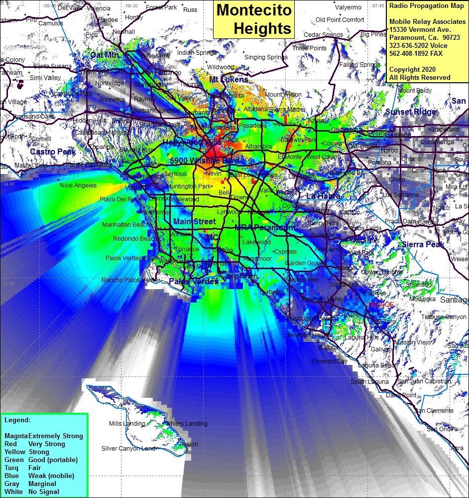 Montecito Heights Coverage |
| Latitude: | 034 05 05.9N | 34.0849722 |
| Longitude: | 118 12 12.8W | -118.2035556 |
| Feet | Meters | |
| Ground Elevation: | 790.0 | 240.8 |
| HAAT: | 453.5 | 138.2 |
| City: | Montecito Heights | |
| County: | Los Angeles | |
| State: | California |
This is not an MRA Owned Site. For space rental contact the site owner.
Do you own or manage this site? Click Here
Would you like to add a site to the Google Earth Map?? Click Here
Site Coverage: Coverage of the LA Basin, Downtown LA, Mid Cities, north Orange County and south to El Toro, South Bay, Santa Monica, San Gabriel Valley, Burbank, Sun Valley, San Dimas, Holywood
Amateur (ham) frequencies: