Mt Adelaide
| Site Name: | Mt Adelaide | 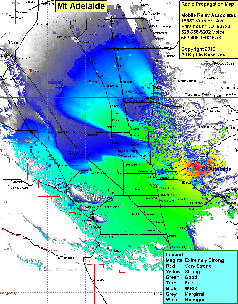 Mt Adelaide Coverage |
| Latitude: | 035 25 47.2N | 35.4297778 |
| Longitude: | 118 44 59.0W | -118.7497222 |
| Feet | Meters | |
| Ground Elevation: | 3,414.0 | 1,040.6 |
| HAAT: | 1303.7 | 397.4 |
| City: | Bakersfield | |
| County: | Kern | |
| State: | California |
This is not an MRA Owned Site. For space rental contact the site owner.
Do you own or manage this site? Click Here
Would you like to add a site to the Google Earth Map?? Click Here
Site Coverage: Coverage of the San Joaquin Valley south to Grapevine and north to Visalia, Bakersfield, Arvin, Edison, Lonsmith, Bealville, Oildale, Oil City,Maltha, Maricopa, Pentland, Taft Heights, Ford City, Lokern, Buttonwillow, Missouri Triangle, Blackwella Corner, Allensworth
Amateur (ham) frequencies: