Mt Adelaide II
| Site Name: | Mt Adelaide II | 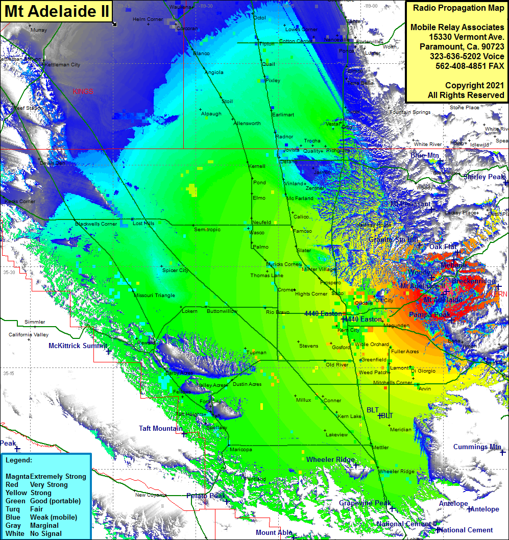 Mt Adelaide II Coverage |
| Latitude: | 035 26 16.8N | 35.4380000 |
| Longitude: | 118 44 27.8W | -118.7410556 |
| Feet | Meters | |
| Ground Elevation: | 3,526.0 | 1074.7 |
| HAAT: | 1,305.7 | 398.0 |
| City: | Bakersfield | |
| County: | Kern | |
| State: | California |
This is not an MRA Owned Site. For space rental contact the site owner.
Do you own or manage this site? Click Here
Would you like to add a site to the Google Earth Map?? Click Here
Site Coverage: Coverage of the San Joaquin Valley, south to Grapevine, north to Tulare, Bakersfield, Bena, Arvin, Edison
Amateur (ham) frequencies: