Mt Harvard
| Site Name: | Mt Harvard | 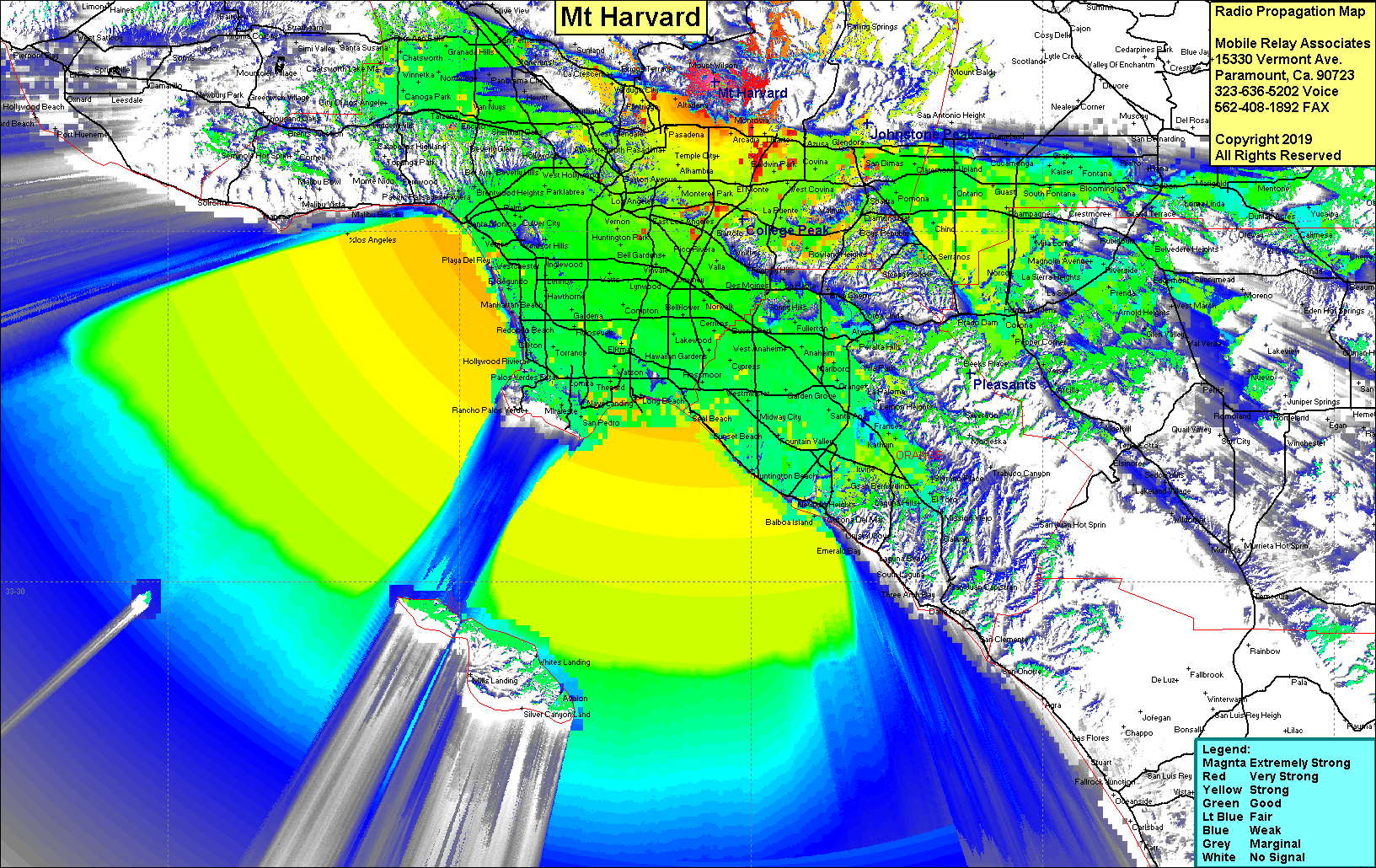 Mt Harvard Coverage |
| Latitude: | 034 12 47.7N | 34.2132500 |
| Longitude: | 118 03 44.5W | -118.0623611 |
| Feet | Meters | |
| Ground Elevation: | 5,433.0 | 1,656.0 |
| HAAT: | 2,913.4 | 888.0 |
| City: | Pasadena | |
| County: | Los Angeles | |
| State: | California |
This is not an MRA Owned Site. For space rental contact the site owner.
Do you own or manage this site? Click Here
Would you like to add a site to the Google Earth Map?? Click Here
Site Coverage: Coverage of the LA Basin, Orange County, San Fernando Valley, San Gabriel Valley, Inland Empire
Amateur (ham) frequencies: