Mt Lospe
| Site Name: | Mt Lospe | 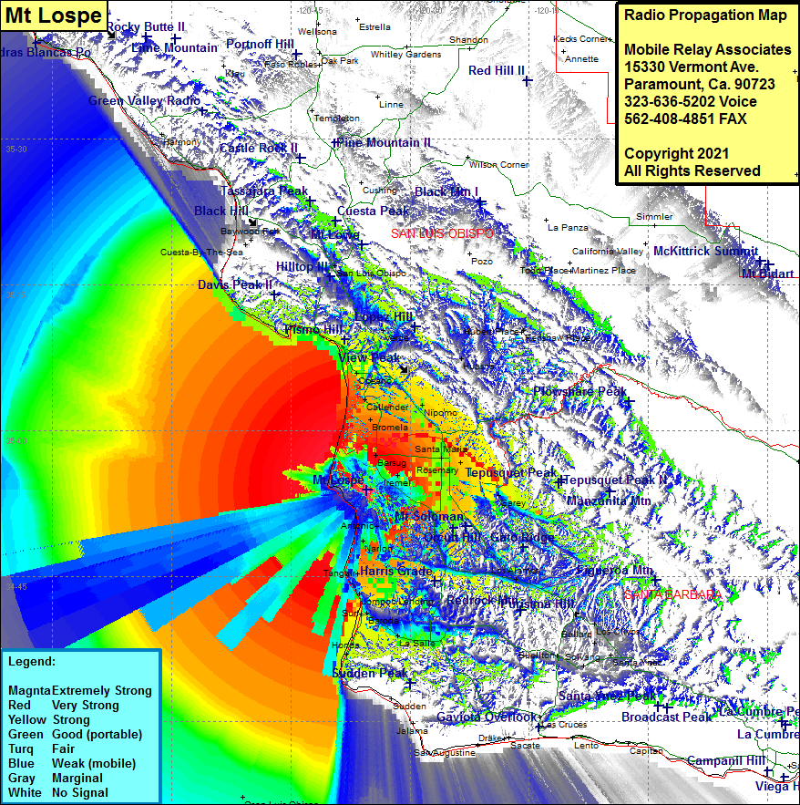 Mt Lospe Coverage |
| Latitude: | 034 53 52.5N | 34.8979167 |
| Longitude: | 120 35 26.2W | -120.5906111 |
| Feet | Meters | |
| Ground Elevation: | 1617.0 | 492.9 |
| HAAT: | 1469.3 | 447.9 |
| City: | Barsug | |
| County: | Santa Barbara | |
| State: | California |
This is not an MRA Owned Site. For space rental contact the site owner.
Do you own or manage this site? Click Here
Would you like to add a site to the Google Earth Map?? Click Here
Site Coverage: Coverage of Honda, Baroda, LaSalle, Lompoc, Surf, Lompoc Landing, Tangair, Narlon, Antonio, Casmalia, Shuman, Waldorf, Irenel, Betteravia, Bragur, Carr, Pacer, Midco, Santa Maria, Rosemary, North Santa Maria, Barsug, Garey, Sisquoc, Rex, Oceano, Halcyon, Arroyo Grande, Grover City, Nipomo, Bromela, Callender, Pismo Beach, Shell Beach, Mallagh Landing, Sycamore Springs, Aviila Beach, Port San Luis, Verde, Edna, San Luis Obispo, Cuesta-By-The-Sea, Cayucos