Mt McDill
| Site Name: | Mt McDill | 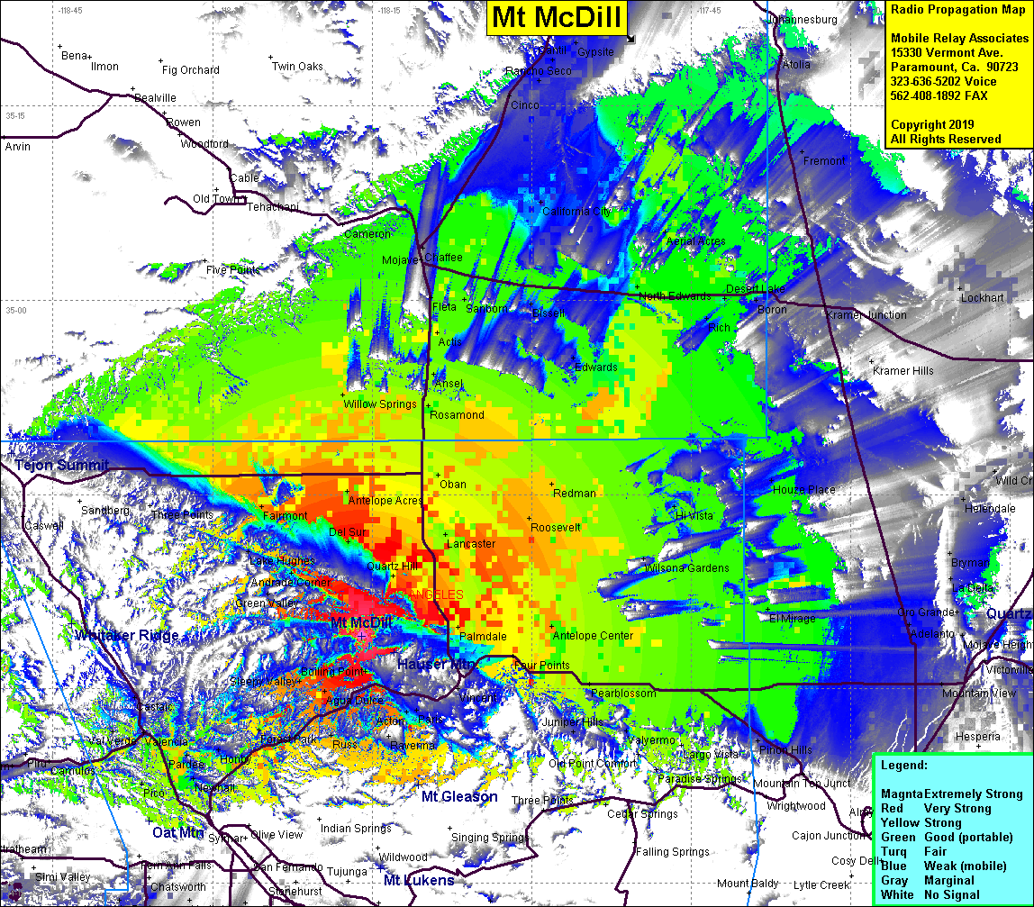 Mt McDill Coverage |
| Latitude: | 034 34 04.2N | 34.5678333 |
| Longitude: | 118 16 01.1W | -118.2669722 |
| Feet | Meters | |
| Ground Elevation: | 5,121.0 | 1,560.9 |
| HAAT: | 2,066.4 | 629.8 |
| City: | Acton | |
| County: | Los Angeles | |
| State: | California |
This is not an MRA Owned Site. For space rental contact the site owner.
Do you own or manage this site? Click Here
Would you like to add a site to the Google Earth Map?? Click Here
Site Coverage: Coverage of the High Desert, Palmdale, Lancaster, Rosamond, Pearblossom, Edwards, Leona Valley, Sleepy Valley, Newhall, Pico
Amateur (ham) frequencies: