Mt Pheasant
| Site Name: | Mt Pheasant | 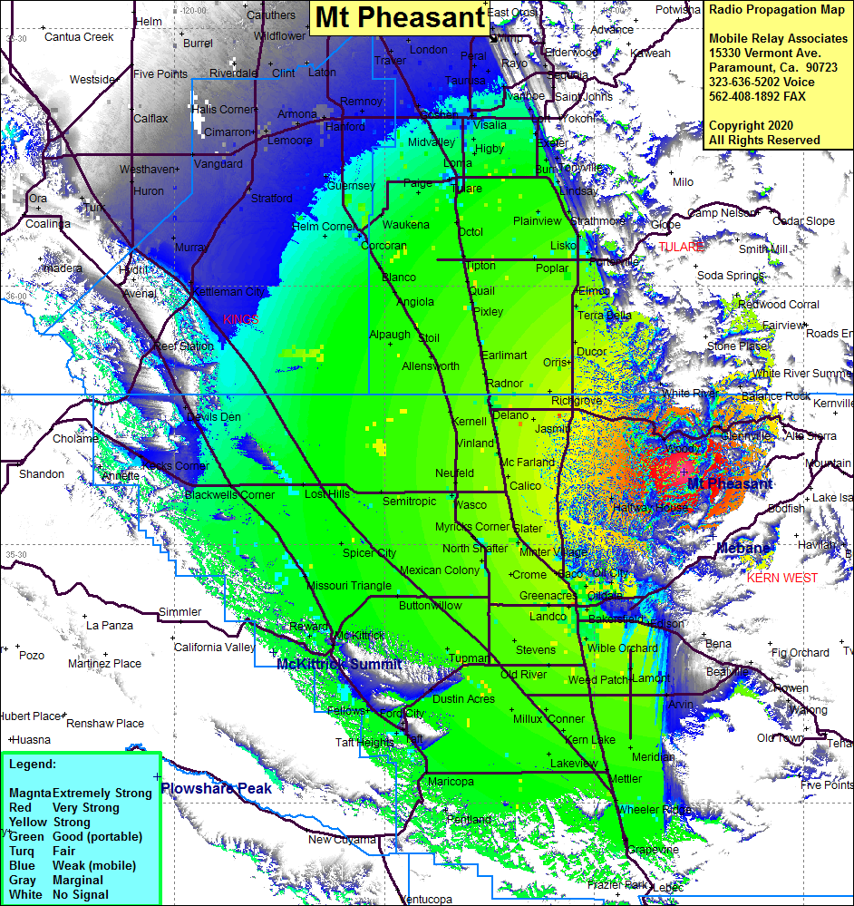 Mt Pheasant Coverage |
| Latitude: | 035 38 26.4N | 35.6406667 |
| Longitude: | 118 47 09.4W | -118.7859444 |
| Feet | Meters | |
| Ground Elevation: | 3625.3 | 1105.0 |
| HAAT: | 1046.9 | 319.1 |
| City: | Woody | |
| County: | Kern | |
| State: | California |
This is not an MRA Owned Site. For space rental contact the site owner.
Do you own or manage this site? Click Here
Would you like to add a site to the Google Earth Map?? Click Here
Site Coverage: Coverage of the San Joaquin Valley south to Grapevine and north to Fowler, Halfway House, Woody, Glenville, Pettit Place, Oil City Oildale, Oil Jct, Prospero, Bakersfield, Magunden, Arvin, Edison, White River, Posey, White River, Deer Creek
Amateur (ham) frequencies: