Mt Soledad II
| Site Name: | Mt Soledad II | 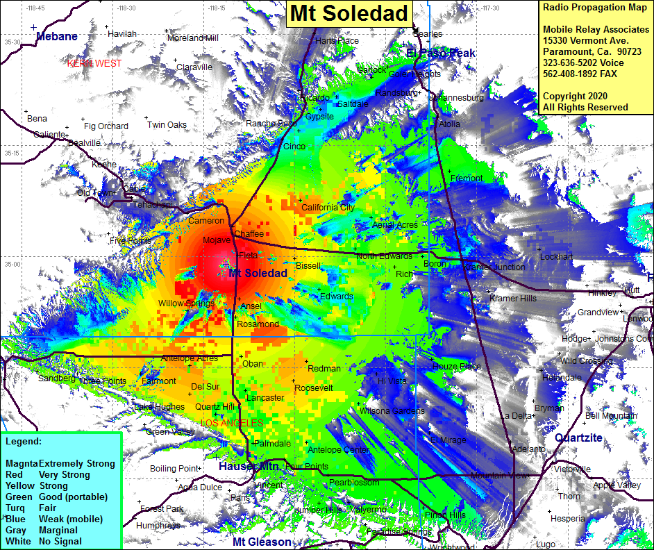 Mt Soledad II Coverage |
| Latitude: | 034 58 54.5N | 34.9818056 |
| Longitude: | 118 11 19.9W | -118.1888611 |
| Feet | Meters | |
| Ground Elevation: | 4156.0 | 1266.7 |
| HAAT: | 1394.1 | 424.9 |
| City: | Mojave | |
| County: | Kern | |
| State: | California |
This is not an MRA Owned Site. For space rental contact the site owner.
Do you own or manage this site? Click Here
Would you like to add a site to the Google Earth Map?? Click Here
Site Coverage: Coverage of the Mojave Desert, Mojave, Bissell, California City, Cinco, Rancho Seco, Daley Mill, Saltdale, Rosamond, Lancaster, Palmdale, Antelope Center, Wilsona Gardens, Hi Vista, Houze Place, Kramer Jct, Boron, Edwards, Fremont, Atolia, Fairmont, Antelope Acres, Willow Springs, Sandberg
Amateur (ham) frequencies: