Mt Soloman
| Site Name: | Mt Soloman | 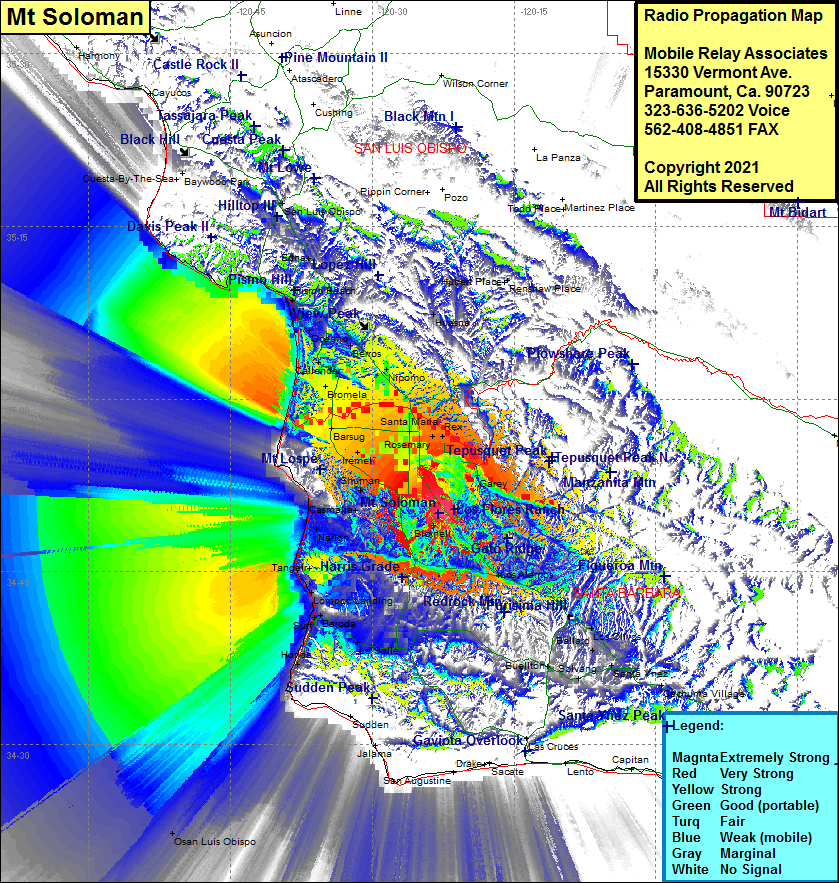 Mt Soloman Coverage |
| Latitude: | 034 50 05.3N | 34.8348056 |
| Longitude: | 120 22 59.7W | -120.3832500 |
| Feet | Meters | |
| Ground Elevation: | 1346.0 | 410.3 |
| HAAT: | 797.0 | 242.9 |
| City: | Orcutt | |
| County: | Santa Barbara | |
| State: | California |
This is not an MRA Owned Site. For space rental contact the site owner.
Do you own or manage this site? Click Here
Would you like to add a site to the Google Earth Map?? Click Here
Site Coverage: Coverage of Narlon, Antonio, Camalia, Shuman, Waldorf, Iremel, Bragur, Carr, Pacer, Midco, Orcutt, Santa Maria, North Santa Maria, Rex, Garey, Sisquoc, Nipomo, Bromela, Callender, Berros, Huasna, Arroyo Grande, Pismo Beach, Shell Beach, Los Alamos, Bricknell, Tangair, Lompoc Landing, Surf, Baroda, LaSalle, Honda, Solvang, Santa Ynez, Ballard, Los Olivos, Verde, Edna, Mallagh Landing, Sycamore Springs, Avila Beach, Port San Luis, San Luis Obispo
Amateur (ham) frequencies: