Oil Field II
| Site Name: | Oil Field II | 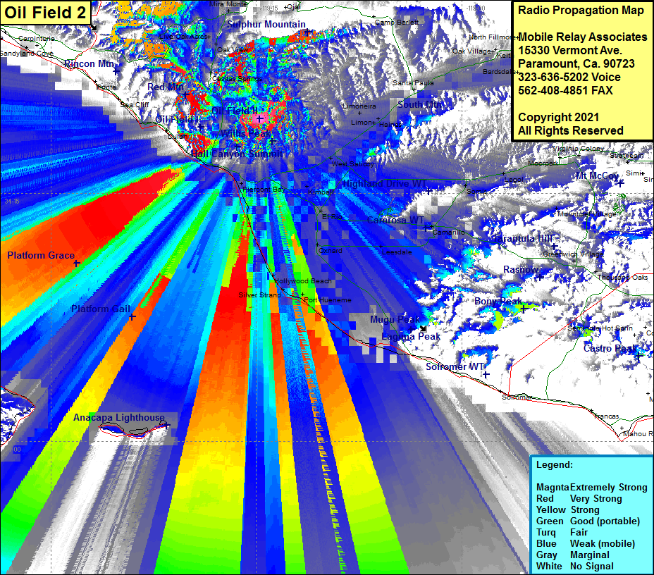 Oil Field II Coverage |
| Latitude: | 034 19 29.3N | 34.3248056 |
| Longitude: | 119 14 45.4W | -119.2459444 |
| Feet | Meters | |
| Ground Elevation: | 1008.0 | 307.2 |
| HAAT: | 501.0 | 152.7 |
| City: | Ventura | |
| County: | Ventura | |
| State: | California |
This is not an MRA Owned Site. For space rental contact the site owner.
Do you own or manage this site? Click Here
Would you like to add a site to the Google Earth Map?? Click Here
Site Coverage: Coverage of Ventura, Wadstrom, Ortonville, Weldons, Casitas Springs, Oak View, Live Oak Acres, Mira Monte, Meiners Oak, Arbolada, Ojala, Dulah, Pierpont Bay, Hollywood Beach, Silver Strand, Port Hueneme, Oxnard, Leesdale, Nyland, El Rio, Kimball, Montalvo, West Saticoy, Limon, Limoneira, Santa Paula, Kevet, Oak Village, Keith, Sespe, Somis, Legol, Camarillo, Mountclef Village, Fairview, Epworth, Greenwich Village, Thousand Oaks
Amateur (ham) frequencies: