Pajuela Peak
| Site Name: | Pajuela Peak | 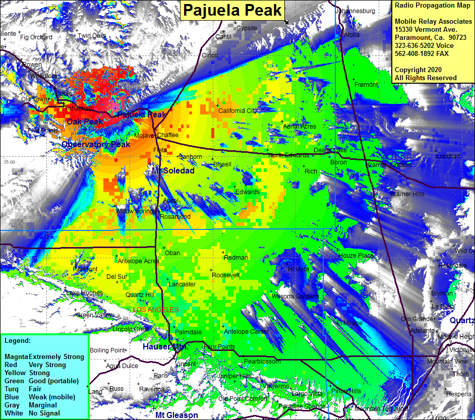 Pajuela Peak Coverage |
| Latitude: | 035 07 14.1N | 35.1205833 |
| Longitude: | 118 17 38.9W | -118.2941389 |
| Feet | Meters | |
| Ground Elevation: | 5763.8 | 1756.8 |
| HAAT: | 1641.1 | 500.2 |
| City: | Cameron | |
| County: | Kern | |
| State: | California |
This is not an MRA Owned Site. For space rental contact the site owner.
Do you own or manage this site? Click Here
Would you like to add a site to the Google Earth Map?? Click Here
Site Coverage: Coverage of Mojave, Antelope Acres, Del Sur, Quartz Hill, Palmdale, Lancaster, Roosevelt, Redman, Littlerock, Pearblossom, Pinon Hills, Largo Vista, Juniper Hills, Houze Place, Kramer Junction, Boron, Edwards, Fremont, Aerial Acres, California City, Rancho Seco, Adelanto, Kramer Hills, Fleta, Chaffee, Fairmont
Amateur (ham) frequencies: