Pampa Peak
| Site Name: | Pampa Peak | 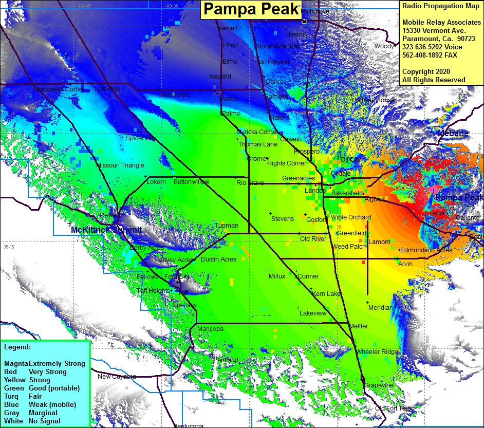 Pampa Peak Coverage |
| Latitude: | 035 22 00.5N | 35.3668056 |
| Longitude: | 118 43 30.0W | -118.7250000 |
| Feet | Meters | |
| Ground Elevation: | 2665.7 | 812.5 |
| HAAT: | 805.5 | 245.5 |
| City: | Bena | |
| County: | Kern | |
| State: | California |
This is not an MRA Owned Site. For space rental contact the site owner.
Do you own or manage this site? Click Here
Would you like to add a site to the Google Earth Map?? Click Here
Site Coverage: Coverage of the San Joaquin Valley south to Grapevine and north to Porterville, Edison, Bena, Ilmon, Caliente, Bealville, Magunden, Lonsmith, Kayandee, Bakersfield
Amateur (ham) frequencies: