Panorama Radio Site
| Site Name: | Panorama Radio Site | 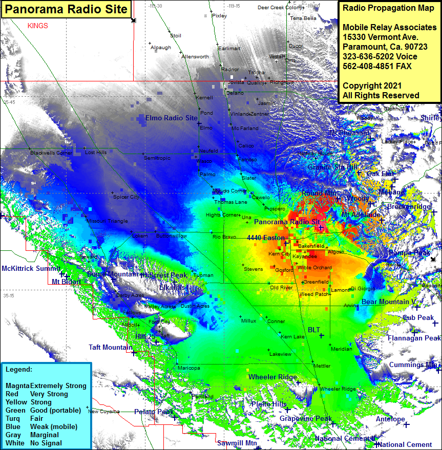 Panorama Radio Site Coverage |
| Latitude: | 035 24 41.2N | 35.4114444 |
| Longitude: | 118 56 37.3W | -118.9436944 |
| Feet | Meters | |
| Ground Elevation: | 846.0 | 257.9 |
| HAAT: | 213.2 | 65.0 |
| City: | Bakersfield | |
| County: | Kern | |
| State: | California |
This is not an MRA Owned Site. For space rental contact the site owner.
Do you own or manage this site? Click Here
Would you like to add a site to the Google Earth Map?? Click Here
Site Coverage: Coverage of Bakersfield, Oil City, Magunden, Edison, Lonsmith, Kayandee, Wible Orchard, Harpertown, Fuller Acres, Lamont, Weed Patch, Rible, DiGiorgio, Mitchells Corner, Edmundson Acres, Meridian, Alameda, Greenfield, Panama, Old River, Kern Lake, Meridian, Lakeview, Conner, Gulf, Millux, Stevens, Gosford, Venola, Kern City, Fruitvale, Greenacres, Rosedale, Calders Corner, Rio Bravo, Una, Hights Corner, Mexican Colony, Oil Junction Saco, Prospero, Lerdo, Minter Village, Slater, Thomas Lane, Shafer, Myricks Corner, Bena, Arvin, Lamont, Mettler, Wheeler Ridge, Maricopa, Midoil, Fellows, Ford City, Valley Acres, Dustin Acres, Darby Acres, Reward, Buttonwillow, Lokern, Missouri Triangle, Spicer City, Lost Hills, Semitropic, Kernell, Pond, Elmo, Newfeld, Wasco, Palmo, Myricks Corner, Thomas Lane, Hights Corner, Prospero, Minter Village, Slater, Famoso, Calico, McFarland, Zentner, Vinland, Delano, Jovista, Radnor, Earlimart, Trocha, Quality, Richgrove, Ducor, Vestal, Orris, Halfway House, Bakersfield, Magunden, Mayfair, Fuller Acres, Bena, Ilmon, Bealville, Woodford
Amateur (ham) frequencies: