Paxton Hill
| Site Name: | Paxton Hill | 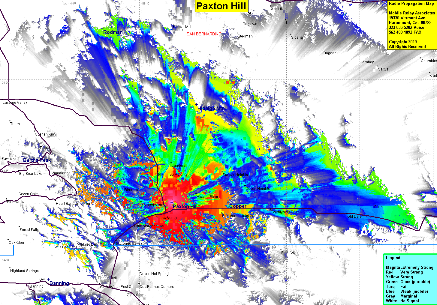 Paxton Hill Coverage |
| Latitude: | 034 09 11.0N | 34.1530556 |
| Longitude: | 116 23 23.5W | -116.3898611 |
| Feet | Meters | |
| Ground Elevation: | 3,806.8 | 1,160.3 |
| HAAT: | 378.1 | 115.2 |
| City: | Yucca Valley | |
| County: | San Bernardino | |
| State: | California |
This is not an MRA Owned Site. For space rental contact the site owner.
Do you own or manage this site? Click Here
Would you like to add a site to the Google Earth Map?? Click Here
Site Coverage: Coverage of Yucca Valley, Twentynine Palms, Old Dale, Panorama Heights, Flamingo Heights, Landers
Amateur (ham) frequencies: