Pine Mountain II
| Site Name: | Pine Mountain II | 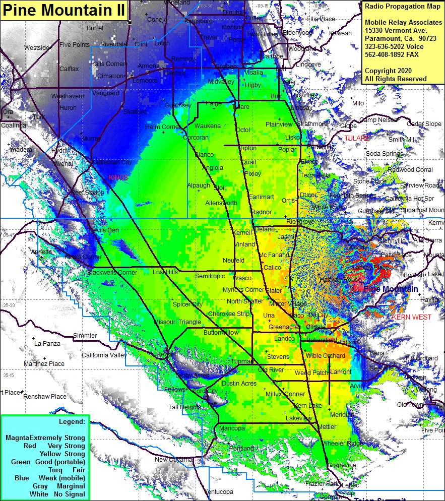 Pine Mountain II Coverage |
| Latitude: | 035 33 39.8N | 35.5610556 |
| Longitude: | 118 46 17.3W | -118.7714722 |
| Feet | Meters | |
| Ground Elevation: | 3887.8 | 1185.0 |
| HAAT: | 1259.4 | 383.9 |
| City: | Bakersfield | |
| County: | Kern | |
| State: | California |
This is not an MRA Owned Site. For space rental contact the site owner.
Do you own or manage this site? Click Here
Would you like to add a site to the Google Earth Map?? Click Here
Site Coverage: Coverage of the San Joaquin Valley south to Grapevine and north to Fowler, Glenville, Woody, Halfway House, Oil City, Oildale, Maltha, Posey, Idlewild, Panorama Heights
Amateur (ham) frequencies: