Pleasant Hill
| Site Name: | Pleasant Hill | 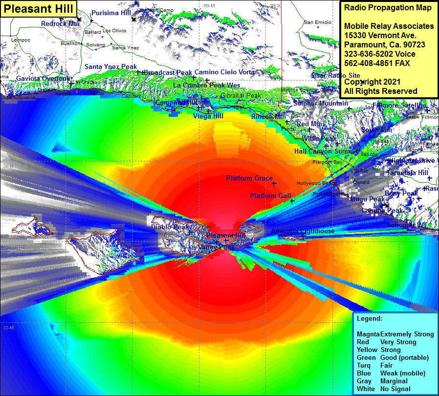 Pleasant Hill Coverage |
| Latitude: | 034 00 08.8N | 34.0024444 |
| Longitude: | 119 38 54.7W | -119.6485278 |
| Feet | Meters | |
| Ground Elevation: | 1457.0 | 444.1 |
| HAAT: | 1399.6 | 426.6 |
| City: | Santa Cruz Island | |
| County: | Santa Barbara | |
| State: | California |
This is not an MRA Owned Site. For space rental contact the site owner.
Do you own or manage this site? Click Here
Would you like to add a site to the Google Earth Map?? Click Here
Site Coverage: Coverage of about 40% of Santa Cruz Island, the eastern portion of Santa Rosa Island, the eastern hills of San Miguel Island, Pierpont Bay, Ventura, Dulah, Sea Cliff, Punta, Carpinteria, Sandyland Cove, Old Town, Summerland, Montecito, Santa Barbara, El Sueno, La Patera, Goleta, Coromar, Ellwood, Naples, Capitan, Tajigual, Lento, Gaviota, Fort Orford, Sacate, Drake, San Augustine, Gato, Concepcion
Amateur (ham) frequencies: