Plowshare Peak
| Site Name: | Plowshare Peak | 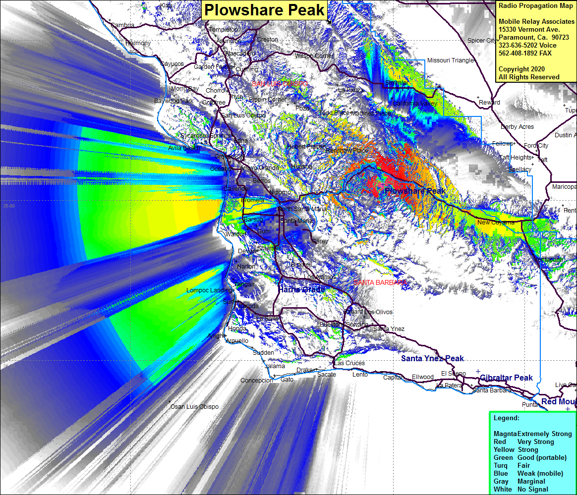 Plowshare Peak Coverage |
| Latitude: | 035 02 59.9N | 35.0499722 |
| Longitude: | 120 02 27.1W | -120.0408611 |
| Feet | Meters | |
| Ground Elevation: | 3920.6 | 1195.0 |
| HAAT: | 1678.6 | 511.6 |
| City: | Santa Maria | |
| County: | Santa Barbara | |
| State: | California |
This is not an MRA Owned Site. For space rental contact the site owner.
Do you own or manage this site? Click Here
Would you like to add a site to the Google Earth Map?? Click Here
Site Coverage: Coverage of Ventucopa, New Cayama, Cayama, Barsug, Santa Maria, North Santa Maria, Rex, Garey, Pacer, Carr, Bragur, Gum, Wardorf, Barsug, Callender, Oceano, Oaks, Grover City, Pismo Beach, Arroyo Grande, Nipomo, Huasna, Renshaw Place, Sisquoc, Casmalia, Devon, California Valley, La Panza, Rosemary, Hwy 166 from Cuyama to Santa Maria
Amateur (ham) frequencies: