Rainbow II
| Site Name: | Rainbow II | 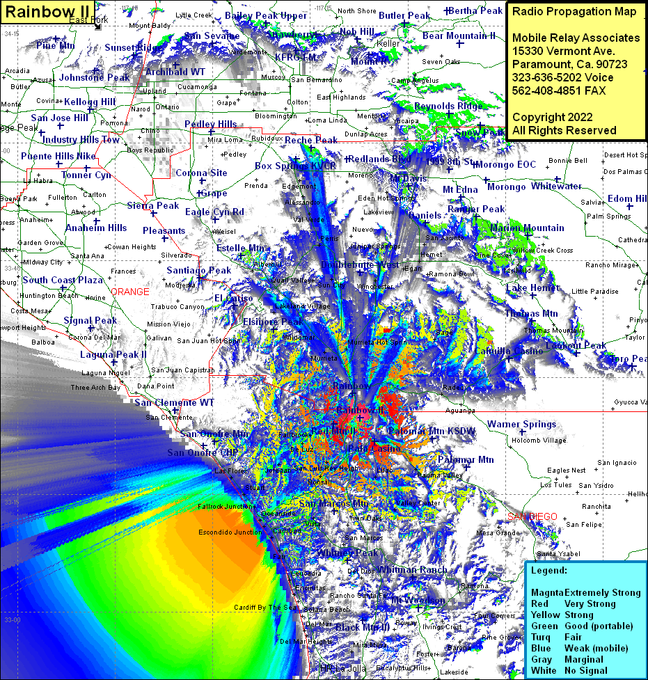 Rainbow II Coverage |
| Latitude: | 033 24 51.7N | 33.4143611 |
| Longitude: | 117 07 23.3W | -117.1231389 |
| Feet | Meters | |
| Ground Elevation: | 2087.0 | 636.1 |
| HAAT: | 881.8 | 268.8 |
| City: | Rainbow | |
| County: | Riverside | |
| State: | California |
This is not an MRA Owned Site. For space rental contact the site owner.
Do you own or manage this site? Click Here
Would you like to add a site to the Google Earth Map?? Click Here
Site Coverage: Coverage of Rainbow, Radec, Anza, Sage, Winchester, Egan, Hemet, Valle Vista, Homeland, Juniper Springs, Gillman Hot Springs, Beaumont, Nicklin, Pauma Valley, Rincon, Lilac, Valley Center, La Jolla Amago, Escondido, Rancho Bernardo, Ramona, Fallbrook, De Luz, Jofegan, Chappo, San Luis Rey Heights, Winterwarm, Pala Mesa, Bonsall, San Luis Rey, Talich, Vista, San Marcos, Buena, Lake San Marcos, Harmony Grove, Oceanside, Escondido Junction, South Oceanside, Carlsbad, Farr, Leucadia, Encinitas, Rancho Sante Fe, Fallbrook Junction, Stuart, Las Flores, Agra, San Onofre, Temecula, Murieta Hot Springs, Wildomar, Sedco Hillsw, Lakeland Village, Lake Elsinore, Elsinore, Quail Valley, Sun City, Romoland, Ellis, Perris, Val Verde, Alessandro, March Field, Edgemont, West March, Arnold Heights, Terra Cotta, Alberhill
Amateur (ham) frequencies: