Ransburg Loop
| Site Name: | Ransburg Loop | 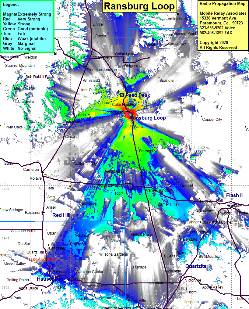 Ransburg Loop Coverage |
| Latitude: | 035 21 46.0N | 35.3627778 |
| Longitude: | 117 38 27.0W | -117.6408333 |
| Feet | Meters | |
| Ground Elevation: | 4150.3 | 1265.0 |
| HAAT: | 1036.7 | 316.0 |
| City: | Ransburg | |
| County: | Kern | |
| State: | California |
This is not an MRA Owned Site. For space rental contact the site owner.
Do you own or manage this site? Click Here
Would you like to add a site to the Google Earth Map?? Click Here
Site Coverage: Coverage of US395 from Victorville in the south and Coso Jct in the north, Johannesburg, Ransburg, Searles, Fremont, Kramer Junction, Kramer Hills, Lockhart, Silt, Boron, portions of Edwards, California City, Cinco, Ricardo, Ridgecrest, China Lake, Indian Wells, Brown, Pearsonville, Freeman Junction, Brown, Linnie, Goler Heights, Garlock, Lockhart, Desert Lake, Rich, Hi Vista, Redman, Roosevelt